Area Overview for Walkerith
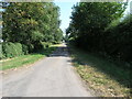
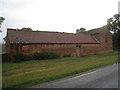
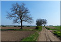
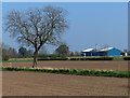
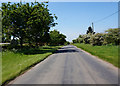
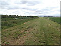
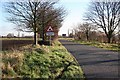
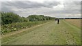
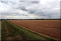
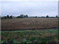
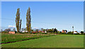
Photos of Walkerith

Area Information
Walkerith is a small civil parish in England that offers a defined, compact living environment covering just 1.2 km². Residents who live in this area experience a neighbourhood where boundaries are clear and the scale is modest. The community is characterised by a long-established presence, evidenced by the demographic profile of those currently residing there. You step into an environment where daily life revolves around a tight-knit group of people rather than a rapidly shifting population. This parish represents a settled locality where the rhythm of daily existence is predictable and grounded. Prospective homebuyers should understand that you are entering a space defined by its simplicity and established tenure. The area does not rely on grand infrastructure or vast commercial zones to sustain it; instead, it functions as a quiet residential enclave. When considering homes in Walkerith, you are looking at a location where the physical footprint is limited, which often means lower travel times within the parish itself. This size constraint creates an intimate setting where neighbours are likely to know each other well. The distinctiveness of the area comes from this concentration of homes within such a small geographic boundary.
- Area Type
- Parish
- Area Size
- 1.2 km²
- Population
- Not available
- Population Density
- Not available
Demographics
The community in Walkerith displays a very distinct age profile that sets it apart from many other residential parishes. The median age stands at 70 years, confirming that the population consists overwhelmingly of older residents. Most people in this locality belong to the senior age group, which shapes the social fabric and the types of services required. Eighty-three per cent of households are owner-occupied, indicating a high level of stability and long-term settlement among those who buy homes in Walkerith. This figure suggests that the area attracts buyers seeking security and permanence rather than a transient rental lifestyle. Household composition in the parish reflects the age of its inhabitants, with domestic structures typically suited to retirees or empty nesters. While specific breakdowns of single-person versus multi-generational families are not detailed in the available records, the dominant median age provides a clear picture of the social dynamic. There is no specific data provided regarding ethnic groups or religious affiliations, so the social composition is understood through the lens of age and tenure alone. The high rate of home ownership implies that property here is treated as a legacy asset passed down or held for life. Residents create an environment where senior citizens are the primary demographic driving community activity.
Household Size
Accommodation Type
Tenure
Ethnic Group
Religion
Household Composition
Age
Household Deprivation
NS-SEC
Explore more demographic insights in this area
Go to Demographics tabPlanning
Planning Constraints
- Flood RiskPremium
- Ramsar Wetland SitesPremium
- Area of Outstanding Natural BeautyPremium
- Protected Nature ReservePremium
- Protected WoodlandPremium
- Crime RiskPremium