Area Overview for Wainfleet Ward
Photos of Wainfleet Ward
Area Information
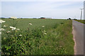
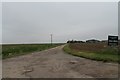
Wainfleet Ward is an electoral ward in East Lindsey, Lincolnshire, covering approximately 56.8 square kilometres. This district includes the market town of Wainfleet All Saints and the neighbouring civil parish of Wainfleet St Mary. The area sits on the east coast about five miles south-west of Skegness and fourteen miles north-east of Boston. It is located near the Lincolnshire Wolds, where the rivers Steeping and Limb meet to form Wainfleet Haven. The village name derives from Old English, meaning a wagon-crossable stream, and first appeared in the Domesday Book in 1086. Residents of Wainfleet Ward live in a setting defined by small rivers and historic conservation areas established in 1972. The market town was designated a conservation area after obtaining a charter of incorporation in 1457. Today, the character remains distinctly rural despite its location on the A52 road. A notable landmark is the Grade I listed Magdalen College School, founded in 1484. The town also features a 15th-century Buttercross in the Market Place and a clock tower from 1899. Daily life here revolves around proximity to natural features and a quiet lifestyle. The ward includes two tumuli of possible Roman or Viking origin. You will find homes near the haven and within walking distance of listed structures like the Barkham Street terrace built in 1847. The railway station on the Nottingham to Skegness line serves the area, though its status as a branch end limits through-services. Living in Wainfleet Ward offers access to coastal scenery while maintaining a connection to the wider East Midlands region. The distinct history of this place, from Roman settlements to Norman times, shapes its current identity. Homes here stand within a landscape that balances agricultural land and protected waterside views.
- Area Type
- District Borough Unitary Ward
- Area Size
- 56.8 km²
- Population
- Not available
- Population Density
- Not available
Demographics
The community in Wainfleet Ward reflects a mature population profile. The median age for residents is seventy years, indicating a very high proportion of older inhabitants. While the data classifier lists the most common age range simply as "Total," the specific median age provides the clearest signal for the demographic makeup. The ward contains a population of approximately 1,604 people, as recorded in the 2011 census. This figure covers both Wainfleet All Saints and Wainfleet St Mary across roughly 1,119 households. Home ownership stands at 57% within this ward. This means just over half of resident households own their properties outright or with a mortgage. The remaining 43% of households are likely renting or living in social housing. Accommodation type data is aggregated into a total figure, meaning specific breakdowns between families, singles, or households with elders are not itemised in the provided statistics. However, the high median age suggests a significant number of retired couples living in the area. The ward does not report specific predominant ethnic groups or religious affiliations in the provided dataset. Deprivation metrics are not included in the available information, but the age profile offers context for local service needs. A population with a median age of seventy places pressure on local medical facilities and care services rather than schooling or youth entertainment. You are joining a neighbourhood where the workforce is largely retired. The community composition is stable, driven by long-term residency rather than seasonal workers. This demographic reality defines the pace of local life and the types of amenities that remain central to the town's function. Safety concerns or employment trends are not highlighted in the available demographic breakdown, reinforcing the picture of a settled, elderly community focused on leisure and established routines.
Household Size
Accommodation Type
Tenure
Ethnic Group
Religion
Household Composition
Age
Household Deprivation
NS-SEC
Explore more demographic insights in this area
Go to Demographics tabPlanning
Planning Constraints
- Flood RiskPremium
- Ramsar Wetland SitesPremium
- Area of Outstanding Natural BeautyPremium
- Protected Nature ReservePremium
- Protected WoodlandPremium
- Crime RiskPremium