Area Overview for Upper Saxondale
Photos of Upper Saxondale


Area Information
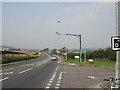
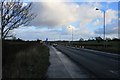
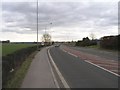
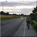
Upper Saxondale is a compact built-up area spanning 25.1 hectares, nestled within England’s landscape. Its character is defined by a mature population, with a median age of 70, reflecting a community that values stability and established living. The area’s proximity to Radcliffe Railway Station and multiple tram stops, including Station Street and Lace Market, ensures easy access to nearby towns and cities. Residents benefit from a well-connected digital environment, with fixed broadband scoring 100 — the highest possible — and mobile coverage rated 84. This makes Upper Saxondale ideal for those requiring reliable internet for work or leisure. The area’s retail options are varied, with nearby stores such as Waitrose Little and Tesco Radcliffe offering convenience. For those seeking travel, Nottingham Airport is within reach, adding to the area’s appeal for frequent flyers. While the population is older, the mix of home ownership (81%) and accessible amenities creates a practical living environment for those prioritising comfort and connectivity over youthful vibrancy. Upper Saxondale is a place where simplicity and reliability are key, with daily life centred around local shops, transport hubs, and a low-crime environment.
- Area Type
- Built Up Area 250
- Area Size
- 25.1 hectares
- Population
- Not available
- Population Density
- Not available
Living in Upper Saxondale offers a blend of local convenience and regional accessibility. The area’s retail options include notable stores such as Waitrose Little, Tesco Radcliffe, and Co-op Radcliffe on, providing everyday shopping needs within easy reach. For transport, residents have access to multiple railway stations, including Radcliffe and Bingham, as well as tram stops like Station Street and Lace Market, facilitating travel to nearby urban centres. The proximity to Nottingham Airport adds to the area’s appeal for those requiring frequent air travel. While the data does not specify parks or leisure facilities, the presence of multiple transport hubs and retail options suggests a community focused on practicality. The lifestyle in Upper Saxondale is defined by accessibility — whether for shopping, commuting, or travel — with amenities designed to serve a mature population. The combination of nearby shops, transport links, and regional connectivity ensures that daily life remains efficient, though the absence of detailed information on recreational spaces means further local investigation is recommended for those prioritising leisure activities.
Amenities
Schools
| Rank | School | Type | Entry gender | Ages |
|---|
Explore more schools in this area
Go to Schools tabDemographics
The demographic profile of Upper Saxondale is shaped by its median age of 70, with the total population encompassing a range of household compositions. Home ownership is high, at 81%, indicating a community where most residents live in properties they own. The accommodation types and household structures are not specified in detail, but the data suggests a stable, settled population. The area’s predominant ethnic group and religious composition are not quantified, so broader conclusions about diversity are not possible. The absence of specific figures on deprivation means that quality of life factors such as access to services or economic hardship cannot be assessed from the available data. However, the high home ownership rate and low crime risk suggest a relatively secure, self-sufficient community. For those considering Upper Saxondale, the demographic makeup reflects a place where older residents form the majority, with living arrangements likely centred around family or single occupancy. The area’s character is defined by its maturity, with residents prioritising stability over change.
Household Size
Accommodation Type
Tenure
Ethnic Group
Religion
Household Composition
Age
Household Deprivation
NS-SEC
Explore more demographic insights in this area
Go to Demographics tabPlanning
Planning Constraints
- Crime RiskPremium