Area Overview for Unstone Green
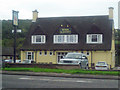
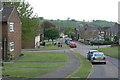
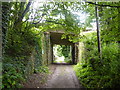
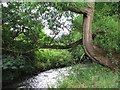
Photos of Unstone Green

Area Information
Unstone Green is a compact built-up area in England, covering 24 hectares. It is home to a population with a median age of 70, indicating a community skewed toward older residents. The area’s proximity to key transport hubs, including Dronfield and Chesterfield railway stations, and retail outlets like Tesco Chesterfield and Morrisons Daily, makes it convenient for daily life. With 64% of homes owned by residents, the area blends established living with practical amenities. Unstone Green’s character is defined by its accessibility to both urban and suburban comforts, supported by a network of rail and local transport options. The high broadband score of 99 ensures reliable digital connectivity, which is vital for both work and leisure. While the area’s demographic profile suggests a mature population, its infrastructure and services cater to a range of needs, making it a viable option for those seeking a balanced lifestyle near key services and transport links.
- Area Type
- Built Up Area 250
- Area Size
- 24.0 hectares
- Population
- Not available
- Population Density
- Not available
Unstone Green offers a range of amenities within practical reach, including retail stores such as Tesco Chesterfield, Morrisons Daily, and Co-op Dronfield, which cater to everyday shopping needs. The area’s rail network provides access to Dronfield, Chesterfield, and Dore & Totley stations, enabling easy travel to nearby towns. A bus stop at the Coach Station adds to the transport options. The metro system includes Herdings Park Platform and White Lane, offering further local mobility. These amenities contribute to a lifestyle that balances convenience with accessibility. The presence of multiple retail options and transport links suggests a community that prioritises practicality, allowing residents to meet daily needs without long commutes. The area’s infrastructure supports both active and sedentary lifestyles, depending on individual preferences.
Amenities
Schools
| Rank | School | Type | Entry gender | Ages |
|---|
Explore more schools in this area
Go to Schools tabDemographics
The population of Unstone Green has a median age of 70, with the most common age range encompassing the total population. This suggests a community predominantly composed of older residents. Home ownership stands at 64%, indicating a mix of owner-occupied properties and rental units. The data does not specify household composition or accommodation types, but the overall figures imply a stable, long-term resident base. The area’s demographic profile reflects a mature population, which may influence local services and amenities. While no explicit data on diversity or deprivation is provided, the absence of specific figures means the community’s social dynamics remain unquantified. The age profile suggests a need for age-appropriate healthcare and leisure facilities, which are likely addressed by nearby services.
Household Size
Accommodation Type
Tenure
Ethnic Group
Religion
Household Composition
Age
Household Deprivation
NS-SEC
Explore more demographic insights in this area
Go to Demographics tabPlanning
Planning Constraints
- Crime RiskPremium