Area Overview for Underwood Ward
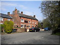
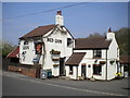
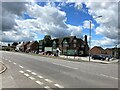
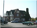
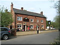
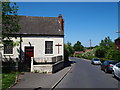
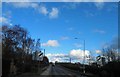
Photos of Underwood Ward
Area Information
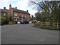
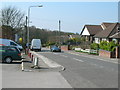
Living in Underwood Ward offers a distinct experience characterised by low density and established communities. The ward covers an area of 6.7 square kilometres, hosting a population of 1,380 people. This results in a population density of 207 people per square kilometre, creating a relatively quiet residential environment. The location serves as a smaller district boroughward within the wider structure of the borough, providing a focused scope for community life. Daily routines here likely involve navigating a mapped area where residents interact within manageable boundaries rather than sprawling metropolitan zones. The scale of the ward means that local amenities and neighbours are often within a short distance, fostering a tight-knit atmosphere. Prospective buyers should note that the total population figure reflects a specific snapshot of residents currently calling this stretch of land home. The geographic spread across 6.7 square kilometres suggests that housing may be spread out, potentially requiring a vehicle for access to services further away from the core. Understanding the precise boundaries helps visualise the distance between properties and the size of the immediate locality. This area presents a straightforward picture of occupancy without the complications of extreme density or urban chaos.
- Area Type
- District Borough Unitary Ward
- Area Size
- 6.7 km²
- Population
- 1380
- Population Density
- 207 people/km²
Demographics
The community in Underwood Ward displays a clear demographic profile driven by age and home ownership patterns. The median age of residents is 70 years, placing this ward distinctly among older populations. While the most common age range data simply indicates the total household composition, the high median age defines the social fabric. With a home ownership rate of 83%, the area is overwhelmingly characterised by owner-occupiers rather than renters. This high percentage suggests a population that has either stayed put for decades or purchased directly into the local market. The data on household composition confirms that families and individuals reside here, though the age skew implies many are likely retired or nearing retirement. Accommodation types in the ward reflect this stability, with most properties serving long-term residents who have established roots. The prevalence of owner-occupancy means that the housing stock is likely filled with people who have invested in improving their homes over time. Diversity data is noted within the total predominantly ethnic group statistics, providing a baseline for the area's makeup. For anyone considering moving here, the high level of ownership indicates a settled community where residents are likely to stay for the long term. The demographics point to a retired demographic living in owned properties, creating a specific type of neighbourly dynamic.
Household Size
Accommodation Type
Tenure
Ethnic Group
Religion
Household Composition
Age
Household Deprivation
NS-SEC
Explore more demographic insights in this area
Go to Demographics tabPlanning
Planning Constraints
- Flood RiskPremium
- Ramsar Wetland SitesPremium
- Area of Outstanding Natural BeautyPremium
- Protected Nature ReservePremium
- Protected WoodlandPremium