Area Overview for Ullesthorpe
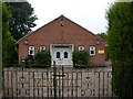
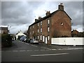
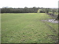
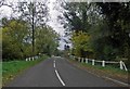
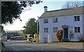
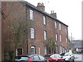
Photos of Ullesthorpe


Area Information
Ullesthorpe is a small built-up area in England, covering 38.3 hectares. Its compact size means it is not a sprawling suburb but a tight-knit community with a distinct character. The median age of 70 suggests a population skewed towards older residents, which shapes the local rhythm of life. This area is not defined by high-rise developments or commercial sprawl but by a quieter, more settled atmosphere. Nearby, the Co-op Linden and Morrisons Lutterworth offer practical retail options, while Hinckley Railway Station provides a link to broader transport networks. For families, the Ullesthorpe Church of England Primary School is the only named institution in the data, indicating a focus on local education. Daily life here is likely to revolve around familiar routines, with a low crime risk score of 72 reinforcing a sense of safety. While the broadband score is modest at 41, mobile coverage is strong at 83, supporting connectivity for those working remotely. Ullesthorpe suits those seeking a simple, low-maintenance lifestyle with proximity to essential services and a community feel.
- Area Type
- Built Up Area 250
- Area Size
- 38.3 hectares
- Population
- Not available
- Population Density
- Not available
Ullesthorpe’s lifestyle is shaped by its proximity to essential amenities. The Co-op Linden, Morrisons Lutterworth, and Spar provide basic retail and grocery needs, creating a small but functional shopping hub. The Hinckley Railway Station is a key transport node, offering access to regional services and potentially linking to larger towns for more extensive shopping or leisure. While the data does not mention parks or recreational facilities, the presence of a primary school and retail outlets suggests a community-oriented environment. The limited number of amenities reflects the area’s small size, which may appeal to those valuing convenience over variety. For residents, daily life likely revolves around familiar local services, with the railway station serving as a gateway to broader opportunities.
Amenities
Schools
The only named school near Ullesthorpe is the Ullesthorpe Church of England Primary School, which serves the local community. The data lists it twice, but it is the sole primary school in the area. No secondary schools or other educational institutions are mentioned, which may mean families need to travel to nearby towns for secondary education. The presence of a primary school indicates that the area is suitable for young families, though the lack of further schooling options could be a consideration. The school’s religious affiliation is noted, but its Ofsted rating is not provided in the data. For parents, the proximity of a primary school is a practical advantage, though additional research would be needed to assess the quality of education beyond primary level.
| Rank | School | Type | Entry gender | Ages |
|---|
Explore more schools in this area
Go to Schools tabDemographics
The population of Ullesthorpe has a median age of 70, the highest in the dataset, indicating a community dominated by older adults. This age profile suggests a demographic that may be more settled, with fewer young families or transient residents. Home ownership is high at 80%, which implies a stable housing market with fewer rental properties. The data does not specify household composition or accommodation types, but the overall ownership rate suggests a mix of owner-occupied homes and possibly some long-term rentals. The absence of detailed diversity metrics means the ethnic and religious composition remains unspecified, though the figures provided suggest a homogenous population. For those considering Ullesthorpe, the high home ownership rate and older demographic may indicate a community with a slower pace of change and a focus on maintaining established local traditions.
Household Size
Accommodation Type
Tenure
Ethnic Group
Religion
Household Composition
Age
Household Deprivation
NS-SEC
Explore more demographic insights in this area
Go to Demographics tabPlanning
Planning Constraints
- Crime RiskPremium