Area Overview for Twycross
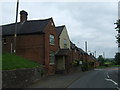
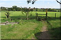
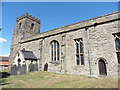
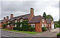
Photos of Twycross
Area Information
Living in Twycross means residing in a compact built-up area spanning 22.7 hectares in England. The community here is defined by its demographic profile, with a median age of 70, suggesting a population skewed towards older adults. This area is not a bustling city but a quiet, established locale with a focus on stability and proximity to essential services. Twycross is served by two independent schools, including Twycross House School, which holds an outstanding Ofsted rating, and Twycross House Pre-Preparatory School, rated good. These institutions cater to families seeking quality education. The area’s transport links are modest but functional, with nearby railway stations such as Shackerstone and Polesworth offering connections to broader networks. Daily life here is likely characterised by a slower pace, with residents prioritising convenience over urban amenities. While the broadband score is low, mobile coverage is robust, supporting connectivity for those working remotely. Twycross appeals to those seeking a quieter, community-oriented lifestyle with access to basic services and educational facilities.
- Area Type
- Built Up Area 250
- Area Size
- 22.7 hectares
- Population
- Not available
- Population Density
- Not available
Residents of Twycross have access to a range of nearby amenities, including retail options and transport links. Within practical reach are five retail outlets, such as Co-op Measham, Tesco Measham, and Heart of England Co-operative Co, providing everyday shopping needs. These stores cater to a community that values convenience, with a mix of local and national brands. The area’s railway stations, including Shackerstone and Polesworth, offer connections to broader networks, facilitating travel to nearby towns and cities. While the data does not mention parks or leisure facilities, the presence of retail and transport hubs suggests a functional lifestyle focused on accessibility. For those prioritising convenience, Twycross offers a compact environment where essential services are within reach. The absence of detailed information on recreational spaces means that those seeking extensive leisure options may need to explore further afield. Nonetheless, the area’s amenities support a practical, low-maintenance lifestyle.
Amenities
Schools
Twycross is served by two independent schools, both of which are rated highly by Ofsted. Twycross House School holds an outstanding rating, indicating exceptional educational standards, while Twycross House Pre-Preparatory School is rated good. These institutions cater to families seeking private education, offering a structured and high-quality learning environment. The presence of two independent schools in the area suggests a community that values academic excellence and is willing to invest in private education. For families with children, this provides a clear advantage, as both schools are likely to offer a range of extracurricular activities and strong pastoral care. However, the data does not mention state schools in the vicinity, so those prioritising public education may need to look further afield. The mix of school types in Twycross reflects a population that includes households with the means to choose private education, reinforcing the area’s demographic profile of older, settled residents.
| Rank | A + A* % | School | Type | Entry gender | Ages |
|---|---|---|---|---|---|
| 1 | N/A | Twycross House School | independent | N/A | N/A |
| 2 | N/A | Twycross House Pre-Preparatory School | independent | N/A | N/A |
Explore more schools in this area
Go to Schools tabDemographics
Twycross has a median age of 70, the highest in the dataset, indicating a population dominated by older adults. This age profile suggests a community with a strong emphasis on retirement or long-term residency. Home ownership stands at 79%, reflecting a majority of residents living in their own homes rather than renting. The data does not specify household composition or accommodation types, but the high home ownership rate implies a stable, settled population. The absence of detailed information on ethnic diversity or religious composition means these factors cannot be addressed here. However, the overall demographic picture points to a mature, low-turnover community where property ownership is the norm. For prospective buyers, this suggests a market with long-term residents and fewer fluctuations in housing demand. The age demographic also means local services and amenities may be tailored to older adults, though the presence of independent schools indicates some family-oriented elements.
Household Size
Accommodation Type
Tenure
Ethnic Group
Religion
Household Composition
Age
Household Deprivation
NS-SEC
Explore more demographic insights in this area
Go to Demographics tabPlanning
Planning Constraints
- Crime RiskLocked