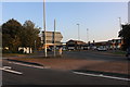
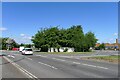
Area Overview for Troon Ward
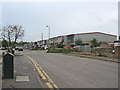
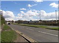
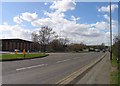
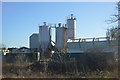
Photos of Troon Ward

Area Information
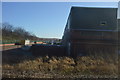
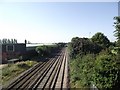
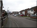
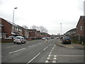
Living in Troon Ward means calling a specific district in Leicester your home. This ward sits within the administrative boundaries of Leicester City Council in the East Midlands region of England. It occupies a compact footprint of just 4.0 km², placing it in the western part of the city centre. The location serves as a key node within Leicester's local government structure, used for administrative purposes and electoral representation. Residents here live in a ward that forms an integral part of the wider city infrastructure. The area's size suggests dense living within city limits, distinct from sprawling suburban developments. You can expect daily life to be shaped by its position as a central ward. The ward's boundaries define the community space for local governance and planning. Its location in the western sector of the city centre offers a defined sense of place. Troon Ward provides a clearly demarcated area for residential life within the larger Leicester urban fabric.
- Area Type
- District Borough Unitary Ward
- Area Size
- 4.0 km²
- Population
- Not available
- Population Density
- Not available
Demographics
The community in Troon Ward has a distinct age profile centred around older residents. The median age stands at 70 years, indicating a population made up largely of senior citizens. Most of the local population falls into the broad category of the total age group, as specific age range breaks are not detailed in the source data. Home ownership is significant here, with 62% of households owning their property. This figure suggests a stable environment where many residents have established long-term ties to their neighbourhood. You will find a higher prevalence of ownership compared to typical city ward demographics. The ward contains a mix of household compositions across its 62% owner-occupied stock. Accommodation types vary throughout the ward, though specific breakdowns by house style are not provided. The demographic makeup reflects a mature community where many families and individuals have settled for life. You live among neighbours who likely prioritise stability and access to local amenities over rapid turnover. Additionally, data regarding the predominant ethnic group and religious affiliation for Troon Ward are not included in the provided records. Consequently, specific details on cultural diversity or faith-based community trends remain outside the scope of this overview. The focus here remains on the clear statistical realities of age and property ownership. These factors shape the daily rhythm of the ward, influencing local business needs and social interactions. A high home ownership rate often correlates with lower household turnover, creating quieter streets. The absence of data on ethnicity prevents a detailed look at demographic diversity, yet the age balance paints a clear picture of the environment.
Household Size
Accommodation Type
Tenure
Ethnic Group
Religion
Household Composition
Age
Household Deprivation
NS-SEC
Explore more demographic insights in this area
Go to Demographics tabPlanning
Planning Constraints
- Flood RiskPremium
- Ramsar Wetland SitesPremium
- Area of Outstanding Natural BeautyPremium
- Protected Nature ReservePremium
- Protected WoodlandPremium
- Crime RiskPremium