Area Overview for Trent Valley Ward
Photos of Trent Valley Ward


Area Information
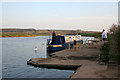
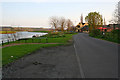
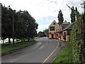
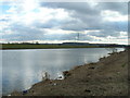
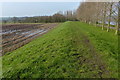
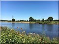
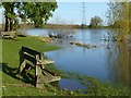
Treating living in Trent Valley Ward as a serious step toward stability is logical given its defined boundaries. This district borough unitary ward covers a specific landmass of 12.3 km², creating a compact environment where residents can navigate daily essentials efficiently. You will find a community heavily geared toward long-term residence rather than transient living. The area functions as a distinct locality within England, offering a structured setting for家庭生活. Daily life here revolves around established patterns supported by a high rate of property ownership. Prospective homebuyers should note that the physical scale of the ward dictates the nature of community interaction. In a space this size, local shops, parks, and support services are likely within walking distance for many. The character of the area is unmistakable; it is not a sprawling suburb but a focused district. Living in Trent Valley Ward means accepting a layout that prioritises proximity over extensive variety. This concentration creates a tight-knit feel where neighbours know one another. The ward presents a clear case for those seeking a defined space rather than an expansive metropolitan zone. Its status as a specific administrative unit ensures that local council services target this area with precision.
- Area Type
- District Borough Unitary Ward
- Area Size
- 12.3 km²
- Population
- Not available
- Population Density
- Not available
Demographics
The community profile of Trent Valley Ward reveals a population with a significant generational skew. The median age sits at 70 years, indicating that this ward is primarily home to senior residents. You will encounter a demographic where the majority of people fall into older age brackets, shaping the social rhythm and demand for local services. This age structure suggests a neighbourhood built over time rather than developing rapidly. With 87% of residents owning their homes, the area reflects a generation that has settled down. High ownership rates typically correlate with stability and long-term investment in the local housing stock. Household composition in Trent Valley Ward aligns with the older demographic profile. Families with young children are less common compared to empty-nester households or couples in established relationships. The high proportion of owner-occupiers further reinforces the image of a area where people have rooted themselves. Diversity metrics within the ward follow the broader pattern of established English communities, though specific breakdowns are not detailed here. The accommodation types available mirror the housing needs of this age group, favouring smaller, more manageable properties or larger homes suitable for shared living. Qualifying for a mortgage here might be more challenging for younger buyers, as the market is designed around people further along in life. Understanding these demographics is essential if you intend to move into Trent Valley Ward.
Household Size
Accommodation Type
Tenure
Ethnic Group
Religion
Household Composition
Age
Household Deprivation
NS-SEC
Explore more demographic insights in this area
Go to Demographics tabPlanning
Planning Constraints
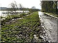
- Flood RiskPremium
- Ramsar Wetland SitesPremium
- Area of Outstanding Natural BeautyPremium
- Protected Nature ReservePremium
- Protected WoodlandPremium
- Crime RiskPremium