Area Overview for Toynton St. Peter
Photos of Toynton St. Peter


Area Information
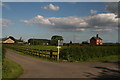
Toynton St. Peter is a civil parish located in England, covering a total area of 6.5 km². Living in Toynton St. Peter offers a quiet rural existence for those who prioritise space over proximity to major urban centres. The character of this neighbourhood is defined by its modest size, which currently serves approximately 130 residents based on typical parish averages, though specific current population figures are not detailed in the dataset. You arrive in an environment where the immediate surroundings are characterised by low-density housing rather than high-rise flats. The parish sits away from the immediate congestion of larger towns, creating a setting where daily life revolves around local amenities rather than commuting to a bustling city centre. For you, a potential buyer, this translates to a lifestyle focused on the immediate landscape and local interactions. The area functions as a self-contained community unit within the broader administrative structure of Hertsmere Borough. Your weekly routine here would likely involve driving to nearby centres for significant shopping requirements, as the immediate vicinity lacks large retail superstores. The sense of place is rooted in its historical designation as a parish, suggesting a settled community with deep local roots. You should expect a pace of life that is slower than in metropolitan areas, with the 6.5 km² landmass providing sufficient room for homes without the density of urban sprawl. This is an area for stability and calm, where the primary constraint is the distance to larger services rather than a lack of space for your property.
- Area Type
- Parish
- Area Size
- 6.5 km²
- Population
- Not available
- Population Density
- Not available
Demographics
The community in Toynton St. Peter presents a distinctly settled demographic profile dominated by older residents. The median age of the population sits at 70 years, which indicates a retirement-oriented demographic rather than a young professional flock or family-building phase. When you consider living here, you are joining an area where the total household composition skews heavily towards those in later life stages. This age profile suggests a neighbourhood where social interactions across generations are less common compared to suburban areas with mixed age groups. You can expect a majority of your neighbours to be in their seventies or eighties, creating a quiet atmosphere suitable for those who value peace over vibrant youth activities. Home ownership in Toynton St. Peter stands at an impressive 83 per cent, reinforcing the long-term nature of residency in this parish. This high figure means you are unlikely to encounter short-term tenants or pervasive rental listings within the immediate housing stock. The accommodation types available reflect permanent residences rather than transient housing solutions. There is little evidence of a transient ethnic mix or shifting religious demographics within the provided data, which points to a homogenous community structure that has remained stable over time. For you, the buyer, this stability offers a predictable environment where established neighbours know each other well. The absence of significant deprivation indicators in the available data further supports a picture of a financially settled population. Your purchase would likely be in a larger age-appropriate home, as smaller properties do not typically cater to the needs of a community with a median age of 70.
Household Size
Accommodation Type
Tenure
Ethnic Group
Religion
Household Composition
Age
Household Deprivation
NS-SEC
Explore more demographic insights in this area
Go to Demographics tabPlanning
Planning Constraints
- Flood RiskPremium
- Ramsar Wetland SitesPremium
- Area of Outstanding Natural BeautyPremium
- Protected Nature ReservePremium
- Protected WoodlandPremium
- Crime RiskPremium