Area Overview for Towcester
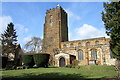
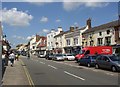
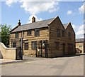
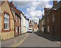
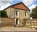
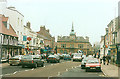
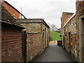
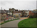
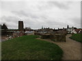
Photos of Towcester

Area Information
Towcester is a compact built-up area in England, spanning 3.8 km² and home to a population skewed toward older age groups. The median age here is 70, suggesting a community with a strong presence of retired residents. Despite its small size, Towcester offers a mix of amenities that cater to daily needs, from retail outlets like Waitrose and Co-op to primary schools that serve local families. The area’s proximity to motorways and towns like Northampton ensures practical connectivity for commuters. For those seeking a quieter lifestyle, the low crime risk score of 74/100 indicates a generally safe environment. While the demographic data shows high home ownership—73% of residents own their properties—this doesn’t detract from the area’s appeal for buyers looking for stable, well-maintained homes. Living in Towcester means balancing a rural feel with access to essential services, making it a viable choice for those prioritising safety and convenience over urban vibrancy.
- Area Type
- Built Up Area 250
- Area Size
- 3.8 km²
- Population
- Not available
- Population Density
- Not available
Towcester’s lifestyle is shaped by its accessible amenities, including retail options such as Waitrose Towcester, Co-op Watling, and M&S Northampton BP. These venues provide a range of shopping and fueling options within practical reach, catering to daily needs without requiring long commutes. The presence of multiple primary schools adds to the area’s family-friendly appeal, though leisure and recreational facilities are not explicitly listed. The compact size of Towcester means that residents can access these amenities without significant travel, contributing to a convenient, low-stress lifestyle. The combination of retail outlets and educational institutions suggests a community focused on practicality, where essentials are within easy reach. For those valuing ease of access over expansive leisure options, Towcester offers a straightforward, functional living experience.
Amenities
Schools
Towcester is served by several primary schools, including Towcester Infant School, Nicholas Hawksmoor Primary School, St Lawrence Church of England Junior School, Sponne School Technology College, and Towcester Church of England Primary School. All these institutions cater to younger children, providing a range of educational options for families. The presence of multiple primary schools suggests a focus on early education, which is crucial for young families. While no Ofsted ratings are provided, the variety of school names and types—primarily Church of England and state-funded—indicates a mix of educational philosophies. This diversity allows parents to choose between faith-based or secular schooling, depending on their priorities. For those considering Towcester, the availability of multiple primary schools is a key factor in assessing the area’s suitability for raising children.
| Rank | A + A* % | School | Type | Entry gender | Ages |
|---|---|---|---|---|---|
| 1 | N/A | Towcester Infant School | primary | N/A | N/A |
| 2 | N/A | Nicholas Hawksmoor Primary School | primary | N/A | N/A |
| 3 | N/A | St Lawrence Church of England Junior School | primary | N/A | N/A |
| 4 | N/A | Sponne School Technology College | primary | N/A | N/A |
| 5 | N/A | Towcester Church of England Primary School | primary | N/A | N/A |
Explore more schools in this area
Go to Schools tabDemographics
The population of Towcester has a median age of 70, reflecting a community predominantly composed of older adults. This age profile suggests a demographic where retirement is the norm, with fewer younger households. Home ownership is high, at 73%, indicating that most residents live in properties they own rather than rent. The accommodation types and household compositions are not specified, but the overall data implies a stable, settled population. There is no explicit information on ethnic diversity or religious composition, but the absence of specific figures means these aspects remain unquantified. The area’s demographic makeup likely influences its social dynamics, with a focus on community stability rather than rapid change. For prospective buyers, this profile may signal a mature, low-maintenance environment where property values are likely to remain steady.
Household Size
Accommodation Type
Tenure
Ethnic Group
Religion
Household Composition
Age
Household Deprivation
NS-SEC
Explore more demographic insights in this area
Go to Demographics tabPlanning
Planning Constraints
- Crime RiskLocked