Area Overview for Toton & Chilwell Meadows Ward
Photos of Toton & Chilwell Meadows Ward


Area Information
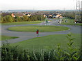
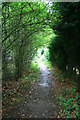
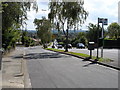
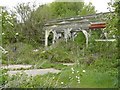
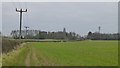
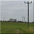
Toton & Chilwell Meadows Ward occupies the southwest corner of Nottinghamshire as a distinct district borough unitary ward covering 3.9 km². This suburban area sits within Broxtowe Borough and encompasses the settlements of Toton and Chilwell Meadows. You are living in a community that shares a unique heritage centred on Chetwynd Barracks, a landmark originally developed from small agricultural villages. The growth of this neighbourhood accelerated after the war as a commuter hub adjacent to Beeston. Modern infrastructure now supports this expansion, with the A52 and M1 motorways providing direct access to wider regions. Originally, the land served as the site for Toton's railway sidings, which expanded into Europe's largest marshalling yards by the 1960s. While the area retains traces of its industrial past, such as the former National Shell Filling Factory No 6, current planning focuses on residential expansion. Recent proposals include the development of Toton Strategic Location for Growth, which allocates 154 ha west of Stapleford Lane. You should be aware that all homes in this ward exist within a landscape defined by this mix of suburban living and significant planning history. Daily life here involves navigating routes through Chetwynd Road and local estates while benefiting from proximity to major transport arteries.
- Area Type
- District Borough Unitary Ward
- Area Size
- 3.9 km²
- Population
- Not available
- Population Density
- Not available
Demographics
The community profile in Toton & Chilwell Meadows Ward reveals a settled population with a median age of 70 years. This indicates a neighbourhood dominated by mature residents who likely settled here decades ago. You will find that 83% of households in the area own their homes outright or with a mortgage. This high rate of ownership suggests a stable community with long-term residents rather than a transient rental market. The ward contains a mixture of housing stock, ranging from 1930s properties around High Road and Chetwynd Road to later post-war local authority estates like Inham Nook and Woodstock Road. Economic history driven by the railway depot and Chambers cardboard factory has shaped the current demographic structure. The economy shifted post-WWII to support the commuter economy that characterises much of the region today. Diversity data regarding predominant ethnic groups and religious affiliations has not been included in the available statistics. While specific figures for these categories are absent from the provided records, the core demographic remains consistent with the overall age profile. When evaluating homes in Toton & Chilwell Meadows Ward, recognise that the population is heavily skewed towards older age groups compared to national averages.
Household Size
Accommodation Type
Tenure
Ethnic Group
Religion
Household Composition
Age
Household Deprivation
NS-SEC
Explore more demographic insights in this area
Go to Demographics tabPlanning
Planning Constraints
- Flood RiskPremium
- Ramsar Wetland SitesPremium
- Area of Outstanding Natural BeautyPremium
- Protected Nature ReservePremium
- Protected WoodlandPremium
- Crime RiskPremium