Area Overview for Toft with Lound and Manthorpe
Photos of Toft with Lound and Manthorpe

Area Information
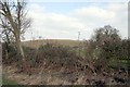
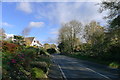
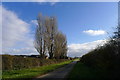
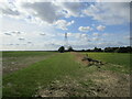
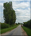
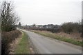
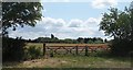
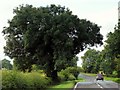
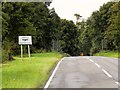
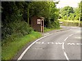
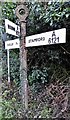
Toft with Lound and Manthorpe is a small civil parish situated in the East Midlands of England. The community covers a total area of 9.8 km², offering a sparse landscape typical of this region. Living in Toft with Lound and Manthorpe involves a quiet existence centred around rural life rather than urban energy. This locality is defined by its established character and low population density. It serves as a peaceful retreat for those seeking a straightforward residential setting away from major city centres. The parish name combines three distinct settlements, indicating a historical evolution of habitation within this specific boundary. You will find homes spread across this relatively compact footprint. Daily life here revolves around local necessities and proximity to surrounding towns. The area lacks the congestion found in larger rural hubs yet maintains the independence of country living. Prospective buyers should view this postcode as a functional, self-contained community. It offers a grounded atmosphere where neighbours know each other well. This location works best for individuals who prioritise silence over social vibrancy. The physical size of the parish limits development potential while preserving open spaces. You are moving into a traditional English rural environment with deep roots.
- Area Type
- Parish
- Area Size
- 9.8 km²
- Population
- Not available
- Population Density
- Not available
Demographics
The community profile of Toft with Lound and Manthorpe reflects a settled population with few young families or recent graduates. The median age in the area stands at 70 years, positioning it as one of the oldest neighbourhoods in the region. Most residents fall into the older age brackets, creating a demographic dominated by retirees and long-term dwellers. Eighty-two per cent of households have attained full home ownership. This figure indicates that the vast majority of people living in Toft with Lound and Manthorpe hold title deeds to their properties. Rental accommodation is a minor feature of the local economy. The household composition suggests stability with limited turnover of residents. You will encounter a community where generations have remained in place. There is little evidence of empty housing within the stock. The high percentage of ownership drives up the average tenure of residents. This snapshot reveals a demographic that values permanence over mobility. Elderly social events and health services likely supplant many modern gym culture activities. The age profile means your neighbours will likely be peers or contemporaries rather than the young independents found elsewhere.
Household Size
Accommodation Type
Tenure
Ethnic Group
Religion
Household Composition
Age
Household Deprivation
NS-SEC
Explore more demographic insights in this area
Go to Demographics tabPlanning
Planning Constraints
- Flood RiskLocked
- Ramsar Wetland SitesLocked
- Area of Outstanding Natural BeautyLocked
- Protected Nature ReserveLocked
- Protected WoodlandLocked
- Crime RiskLocked