Area Overview for Tithby
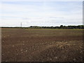
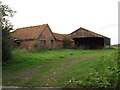
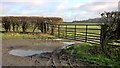
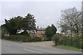
Photos of Tithby


Area Information
Tithby is a small civil parish located in England, covering a land area of 3.2 km². Living in Tithby offers a quiet experience within a community defined by its compact size and established character. The area functions as a self-contained locality where daily life revolves around immediate local needs rather than long commutes to distant urban centres. You can expect a environment that has developed over time, resulting in a distinct rhythm to the day. The residential nature of the parish means your surroundings will likely consist of established homes set within a defined boundary. Because the total area is relatively small, distances between properties are short, allowing for quick access to local amenities within the parish itself. This scale often fosters an atmosphere where neighbours know each other, creating a supportive network without the density of larger towns. Residents appreciate the straightforward geography of the village, which avoids the complexity of sprawling suburbs. The land extends over just over three square kilometres, ensuring that you can traverse the main areas easily on foot or by bicycle. This limited footprint concentrates the community, making it a manageable space for families or individuals seeking a settled home life away from the hustle of city centres. The community in Tithby reflects a specific demographic profile with a median age of 70. This figure indicates that the population skews significantly towards older residents who have likely lived in the same properties for decades. The most common age range data categorises the entire population as 'Total', confirming that every person counted contributes to a single average age calculation rather than a broad spread across multiple generations. Home ownership stands at an impressive 84%, meaning the vast majority of people living in Tithby own their homes outright or are paying for them rather than renting. This high rate of ownership suggests a community that is settled and invested in the long-term stability of the area. When you look at accommodation types and household composition, the data provides a 'Total' label, which implies a uniformity where the aggregate figures represent the entire residential makeup without significant sub-group variations. This demographic picture paints a clear portrait of a mature neighbourhood. You will find that most neighbours are established residents rather than recent movers. The high ownership percentage also means challenges related to landlord turnover are minimal. Residents enjoy the security of stability, as most households are not dependent on rental contracts that may expire or change terms frequently. The area functions as a home for those who have built their lives there. The property market in Tithby is overwhelmingly dominated by owner-occupied homes, with 84% of dwellings belonging to their occupants. This statistic is a defining feature of selling or buying in the parish. When you consider accommodation types and household composition, the market looks less like a fluid rental landscape and more like a permanent residential zone. Most homes in Tithby have been purchased by people intending to stay for the foreseeable future. Because owner occupation is so high, rental supply will be naturally limited compared to towns with large student populations or busy city centres. Buyers looking at Tithby should expect a market driven by existing residents who upgrade rather than by new investors seeking quick returns. The majority of stock will likely consist of properties that have been lived in for many years, offering a chance to buy a home with history. You will find that competition for purchases comes primarily from retirees or families seeking a quiet place to settle. The lack of a significant rental sector means price fluctuations are often driven by local satisfaction and housing availability rather than rental yields or speculative demand. If you are thinking of buying Tithby, you are entering a market where sentiment is grounded in long-term living rather than short-term investment strategies. The high ownership rate provides assurance that when a property becomes available, the seller is likely motivated by life changes rather than market speculation. Safety and environmental conditions in Tithby present a concerning contrast. The crime risk assessment passes with a safety score of 88 out of 100, indicating a neighbourhood with below-average crime rates. You can feel reassured that the likelihood of encountering criminal activity is low compared to other areas. Local policing and community vigilance keep the streets quiet, supporting the predominantly elderly demographic's need for security. However, you must address the critical flood risk factor directly. The flood risk assessment scores a low 34.94, which signifies high flood risk coverage across the parish. This score indicates that a significant portion of the area is prone to waterlogging or inundation during heavy weather events. You should inspect any property carefully to understand its specific elevation and history. Rainfall in this area can lead to serious flooding issues that impact daily life and insurance costs. Despite this natural hazard, planning constraints do not severely restrict development or land use. There is no Ramsar wetland site coverage, meaning you do not live within a protected international wetland zone that might limit building works. The area also does not fall within an Area of Outstanding Natural Beauty or contain a protected nature reserve, which removes certain bureaucratic hurdles for local maintenance and modification. Protected woodland in Tithby is similarly absent from the assessments. While the natural landscape is valuable to residents, the lack of designated protected woodland means the area is not subject to the strict conservation laws that apply to other wildlife sites. This allows for a degree of flexibility in how the land is managed and maintained by local authorities and homeowners. Who typically lives in Tithby?Tithby has a distinctively mature community with a median age of 70. The population is dominated by older residents who have settled in the parish for a long time. Only accounts for the 'Total' age range, highlighting the uniformity of this demographic rather than a mix of young professionals and families. Is Tithby a safe place to live?Yes, the crime risk assessment gives Tithby a passing grade with a score of 88 out of 100. These figures confirm that the area has below-average crime rates and a safer neighbourhood profile compared to the wider region. Residents generally feel secure in their local streets. What is the main environmental concern for residents?The most significant issue facing residents is flood risk, which rates as critical with a score of 34.94 out of 100. High flood risk coverage suggests that substantial parts of the parish are vulnerable to water-related damage. Conversely, there are no planning constraints like AONBs or Ramsar sites, ensuring that development regulations are standard.
- Area Type
- Parish
- Area Size
- 3.2 km²
- Population
- Not available
- Population Density
- Not available
Demographics
The community in Tithby reflects a specific demographic profile with a median age of 70. This figure indicates that the population skews significantly towards older residents who have likely lived in the same properties for decades. The most common age range data categorises the entire population as 'Total', confirming that every person counted contributes to a single average age calculation rather than a broad spread across multiple generations. Home ownership stands at an impressive 84%, meaning the vast majority of people living in Tithby own their homes outright or are paying for them rather than renting. This high rate of ownership suggests a community that is settled and invested in the long-term stability of the area. When you look at accommodation types and household composition, the data provides a 'Total' label, which implies a uniformity where the aggregate figures represent the entire residential makeup without significant sub-group variations. This demographic picture paints a clear portrait of a mature neighbourhood. You will find that most neighbours are established residents rather than recent movers. The high ownership percentage also means challenges related to landlord turnover are minimal. Residents enjoy the security of stability, as most households are not dependent on rental contracts that may expire or change terms frequently. The area functions as a home for those who have built their lives there. The property market in Tithby is overwhelmingly dominated by owner-occupied homes, with 84% of dwellings belonging to their occupants. This statistic is a defining feature of selling or buying in the parish. When you consider accommodation types and household composition, the market looks less like a fluid rental landscape and more like a permanent residential zone. Most homes in Tithby have been purchased by people intending to stay for the foreseeable future. Because owner occupation is so high, rental supply will be naturally limited compared to towns with large student populations or busy city centres. Buyers looking at Tithby should expect a market driven by existing residents who upgrade rather than by new investors seeking quick returns. The majority of stock will likely consist of properties that have been lived in for many years, offering a chance to buy a home with history. You will find that competition for purchases comes primarily from retirees or families seeking a quiet place to settle. The lack of a significant rental sector means price fluctuations are often driven by local satisfaction and housing availability rather than rental yields or speculative demand. If you are thinking of buying Tithby, you are entering a market where sentiment is grounded in long-term living rather than short-term investment strategies. The high ownership rate provides assurance that when a property becomes available, the seller is likely motivated by life changes rather than market speculation. Safety and environmental conditions in Tithby present a concerning contrast. The crime risk assessment passes with a safety score of 88 out of 100, indicating a neighbourhood with below-average crime rates. You can feel reassured that the likelihood of encountering criminal activity is low compared to other areas. Local policing and community vigilance keep the streets quiet, supporting the predominantly elderly demographic's need for security. However, you must address the critical flood risk factor directly. The flood risk assessment scores a low 34.94, which signifies high flood risk coverage across the parish. This score indicates that a significant portion of the area is prone to waterlogging or inundation during heavy weather events. You should inspect any property carefully to understand its specific elevation and history. Rainfall in this area can lead to serious flooding issues that impact daily life and insurance costs. Despite this natural hazard, planning constraints do not severely restrict development or land use. There is no Ramsar wetland site coverage, meaning you do not live within a protected international wetland zone that might limit building works. The area also does not fall within an Area of Outstanding Natural Beauty or contain a protected nature reserve, which removes certain bureaucratic hurdles for local maintenance and modification. Protected woodland in Tithby is similarly absent from the assessments. While the natural landscape is valuable to residents, the lack of designated protected woodland means the area is not subject to the strict conservation laws that apply to other wildlife sites. This allows for a degree of flexibility in how the land is managed and maintained by local authorities and homeowners. Who typically lives in Tithby?Tithby has a distinctively mature community with a median age of 70. The population is dominated by older residents who have settled in the parish for a long time. Only accounts for the 'Total' age range, highlighting the uniformity of this demographic rather than a mix of young professionals and families. Is Tithby a safe place to live?Yes, the crime risk assessment gives Tithby a passing grade with a score of 88 out of 100. These figures confirm that the area has below-average crime rates and a safer neighbourhood profile compared to the wider region. Residents generally feel secure in their local streets. What is the main environmental concern for residents?The most significant issue facing residents is flood risk, which rates as critical with a score of 34.94 out of 100. High flood risk coverage suggests that substantial parts of the parish are vulnerable to water-related damage. Conversely, there are no planning constraints like AONBs or Ramsar sites, ensuring that development regulations are standard.
Household Size
Accommodation Type
Tenure
Ethnic Group
Religion
Household Composition
Age
Household Deprivation
NS-SEC
Explore more demographic insights in this area
Go to Demographics tabPlanning
Planning Constraints
- Flood RiskLocked
- Ramsar Wetland SitesLocked
- Area of Outstanding Natural BeautyLocked
- Protected Nature ReserveLocked
- Protected WoodlandLocked
- Crime RiskLocked