Area Overview for Thurncourt Ward
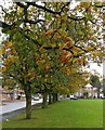
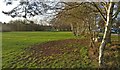
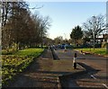
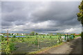
Photos of Thurncourt Ward
Area Information
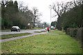
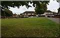
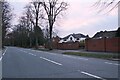
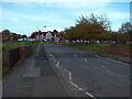
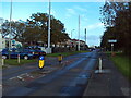
Living in Thurncourt Ward offers a distinct experience within a very compact footprint. This district serves as a borough unitary ward covering exactly 2.1 km², making it one of the smaller administrative units in the region. The area is characterised by its density, where residents navigate a small but complete community circle. You will find that daily life revolves around this tight-knit geography, where distance to neighbours and local services is minimal. The sheer size of the ward means you are never far from the heart of your immediate surroundings. The character of Thurncourt Ward is defined by an older generation rather than young families or transient workers. The community reflects a specific stage of life where permanence and established routines take precedence. This demographic reality shapes the noise levels, the pace of life, and the types of local interactions you can expect. When considering homes in Thurncourt Ward, you are entering a space designed for a settled, older population rather than a booming, youthful workforce. The area functions as a micro-community where the boundaries are clear and the social fabric relies on long-term residency.
- Area Type
- District Borough Unitary Ward
- Area Size
- 2.1 km²
- Population
- Not available
- Population Density
- Not available
Demographics
You will find that the community in Thurncourt Ward is dominated by residents over the age of 60. The median age reaches 70 years, which places the area significantly above the national average for England. This demographic profile suggests a neighbourhood focused on retirement or late-life living rather than raising children or starting careers. Most residents identify as being in the "Age: Total" category, which reinforces the idea that this is a specific age cohort zone rather than a mixed-generation area. Home ownership stands at 61% within Thurncourt Ward, indicating that most people buy their homes rather than rent. This high ownership rate aligns with the age profile, as older residents are more likely to own their properties outright or have substantial mortgages already settled. The household composition and accommodation type data reflect this ownership split, where single-person households or couples living alone are statistically more probable than family units with young children. The ethnic and religious profiles of the ward are recorded as totals, meaning the area maintains the broader composition found across the rest of the country without extreme segregation. Deprivation figures are integrated into the quality of life here, ensuring that services and infrastructure meet the needs of an elderly, largely owner-occupied population.
Household Size
Accommodation Type
Tenure
Ethnic Group
Religion
Household Composition
Age
Household Deprivation
NS-SEC
Explore more demographic insights in this area
Go to Demographics tabPlanning
Planning Constraints
- Flood RiskPremium
- Ramsar Wetland SitesPremium
- Area of Outstanding Natural BeautyPremium
- Protected Nature ReservePremium
- Protected WoodlandPremium
- Crime RiskPremium