Area Overview for Thurnby and Bushby
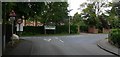
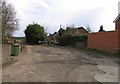
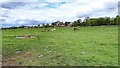
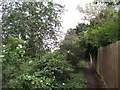
Photos of Thurnby and Bushby
Area Information
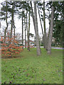
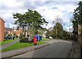
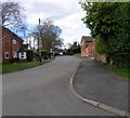
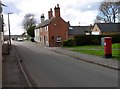
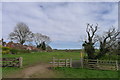
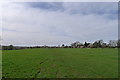
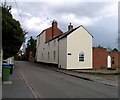
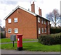
Living in Thurnby and Bushby offers a distinct experience within a compact parish spanning just 4.2 square kilometres. This civil parish sits quietly in the East Midlands, providing a contained environment for those seeking specific residential characteristics. The area is small enough to know everyone but large enough to maintain individual privacy within your home. Your daily life likely revolves around local amenities and the surrounding countryside, given the simple footprint of the settlement. You are not dealing with sprawling suburbs but rather a defined community where distances are short. The name itself combines two villages, suggesting a history of separate settlements that have grown alongside one another. When you consider buying homes in Thurnby and Bushby, you are entering a market defined by stability rather than rapid change. The region attracts residents who value space and quietude over the pace of city living. You will find that the parish offers a straightforward lifestyle without the complexity of larger urban centres. Your neighbours are likely to be long-term residents who understand the local rhythm. The area functions as a self-contained unit where community interactions happen naturally. You can walk to most daily necessities, making this slice of England a practical choice for those who prefer a measured approach to living.
- Area Type
- Parish
- Area Size
- 4.2 km²
- Population
- Not available
- Population Density
- Not available
Demographics
The community in Thurnby and Bushby presents a clear demographic profile dominated by an older population. The median age here stands at 70 years, indicating that the residents are predominantly retirees or older adults. This age structure shapes the social fabric of the parish, with fewer young families or children compared to other parts of the county. As a result, local activities and services cater to a mature demographic rather than a youthful one. Most households are likely composed of older couples or widows, reflecting the high average age of the population. Home ownership in Thurnby and Bushby is extraordinarily high, with 86% of residents owning their homes outright or with a mortgage. This figure signals a neighbourhood where people have stayed put over long periods rather than renting or moving frequently. The high ownership rate suggests a stable population with deep roots in the area. There are little transient elements disrupting the community, as most people have purchased properties to remain. The household composition reinforces this picture of permanence, with very few shared ownership schemes or high-density rental blocks. You will not find significant diversity in terms of ethnicity or religious make-up based on the available records. The area remains largely homogeneous, mirroring the traditional character of many rural parishes in the East Midlands. For you as a buyer, this means a very predictable social environment. The lack of minority representation in the data suggests a tightly knit, traditional community. Your neighbours will likely share similar cultural backgrounds and life experiences. This homogeneity contributes to the area's distinct identity as a place for the elderly rather than a hub for multicultural development.
Household Size
Accommodation Type
Tenure
Ethnic Group
Religion
Household Composition
Age
Household Deprivation
NS-SEC
Explore more demographic insights in this area
Go to Demographics tabPlanning
Planning Constraints
- Flood RiskPremium
- Ramsar Wetland SitesPremium
- Area of Outstanding Natural BeautyPremium
- Protected Nature ReservePremium
- Protected WoodlandPremium
- Crime RiskPremium