Area Overview for Thurmaston
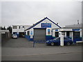
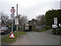
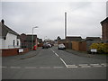
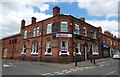
Photos of Thurmaston


Area Information
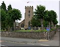
Thurmaston is a compact built-up area in England, covering 2.5 km² and home to 1,402 residents. Its population density of 559 people per square kilometre suggests a tightly knit community, though the area remains relatively small in scale. The median age of 70 indicates a predominantly older demographic, shaping the local character and pace of life. Daily life here is likely defined by proximity to essential services, with nearby schools, retail outlets, and transport links forming the backbone of residents’ routines. Thurmaston’s charm lies in its accessibility: major railway stations like Leicester and Syston are within practical reach, while the nearby Leicester Airport offers regional travel convenience. The area’s blend of retail options, from Asda to Costco, and a range of primary schools ensures families have choices for both education and daily needs. While the population is modest, the infrastructure supports a functional, if unassuming, lifestyle. For those seeking a quiet, established community with practical amenities, Thurmaston offers a straightforward, no-frills living experience.
- Area Type
- Built Up Area 250
- Area Size
- 2.5 km²
- Population
- 1402
- Population Density
- 559 people/km²
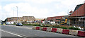
Thurmaston’s lifestyle is shaped by its proximity to retail, dining, and transport hubs. The area is within practical reach of five retail outlets, including M&S Leicester Thurmaston, Costco Leicester, and Asda Thurmaston, offering a mix of everyday shopping and larger supermarket options. While specific dining venues are not listed, the retail presence suggests a range of nearby eateries and services. The rail network, with stations like Leicester and Syston, connects residents to broader leisure and cultural opportunities in nearby towns. The Leicester Airport provides easy access to regional and national travel. The area’s compact nature means amenities are concentrated, making daily errands efficient. However, the lack of detailed information on parks or leisure facilities means the extent of recreational options remains unexplored. Overall, Thurmaston offers a functional lifestyle with essential services close at hand, though those seeking extensive leisure amenities may need to look beyond the immediate area.
Amenities
Schools
Thurmaston is served by a cluster of primary schools, including Church Hill Infant School, Eastfield Primary School, Church Hill Church of England Junior School, Bishop Ellis Catholic Primary School, and Roundhill Community College. All are primary institutions, offering a range of educational options for young families. The presence of multiple schools suggests a well-established network for early education, though secondary school options are not detailed in the data. For families prioritising primary education, the variety of school types—state, church-affiliated, and Catholic—provides flexibility in choosing a school that matches their values or needs. However, the absence of secondary school information means prospective buyers should investigate further if their children will require transition to secondary education. The concentration of primary schools indicates a community focused on supporting local families, though the broader educational landscape beyond primary level remains unclear.
| Rank | A + A* % | School | Type | Entry gender | Ages |
|---|---|---|---|---|---|
| 1 | N/A | Church Hill Infant School | primary | N/A | N/A |
| 2 | N/A | Eastfield Primary School | primary | N/A | N/A |
| 3 | N/A | Church Hill Church of England Junior School | primary | N/A | N/A |
| 4 | N/A | Bishop Ellis Catholic Primary School | primary | N/A | N/A |
| 5 | N/A | Roundhill Community College | primary | N/A | N/A |
Explore more schools in this area
Go to Schools tabDemographics
Thurmaston’s population has a median age of 70, reflecting a community skewed toward older residents. This demographic profile suggests a settled, possibly retired population, with fewer young families compared to other areas. Home ownership is high at 76%, indicating a strong presence of long-term residents who have invested in property. The data does not specify household composition or accommodation types, but the overall figures imply a stable, low-turnover environment. With no breakdown of ethnic groups or religious affiliations provided, the area’s diversity remains unquantified. The age distribution and ownership rates suggest a community prioritising security and familiarity over rapid change. For prospective buyers, this demographic profile may align with those seeking a quiet, mature neighbourhood with established infrastructure, though it may not suit those requiring schools catering to younger children or a more dynamic social scene.
Household Size
Accommodation Type
Tenure
Ethnic Group
Religion
Household Composition
Age
Household Deprivation
NS-SEC
Explore more demographic insights in this area
Go to Demographics tabPlanning
Planning Constraints
- Crime RiskLocked