Area Overview for Thurlby
Photos of Thurlby
Area Information
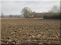
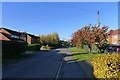
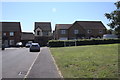
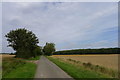
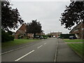
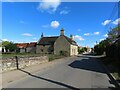
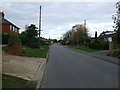
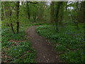
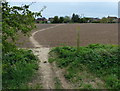
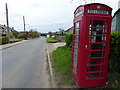
Living in Thurlby offers a distinct blend of practicality and quiet stability. Covering 92.4 hectares, the area is compact yet functional, catering to residents who value accessibility and simplicity. With a median age of 70, the community is predominantly older, reflecting a demographic that prioritises familiar surroundings and established infrastructure. The high home ownership rate of 82% suggests a long-term presence of residents, many of whom may have lived in the area for decades. Daily life is shaped by proximity to essential services: nearby schools, retail outlets, and a bus interchange provide the basics. The area’s broadband score of 100 ensures seamless digital connectivity, supporting both work and leisure. While Thurlby lacks the vibrancy of larger towns, its straightforward character appeals to those seeking a low-maintenance lifestyle. The absence of major transport links or cultural hubs means it’s not for everyone, but for those who value a peaceful, self-contained environment, it offers a reliable foundation.
- Area Type
- Built Up Area 250
- Area Size
- 92.4 hectares
- Population
- Not available
- Population Density
- Not available
Residents of Thurlby have access to a range of essential amenities within practical reach. The retail sector includes five notable outlets: Lidl Bourne, Co-op Bourne, and Tesco Bourne, ensuring everyday shopping needs are met. A bus interchange adds convenience for commuting or visiting nearby towns. While the data does not mention parks or leisure facilities, the presence of multiple shops and transport links suggests a lifestyle focused on practicality rather than recreation. The area’s compact size means residents can access daily necessities without long journeys, though those seeking extensive leisure options may need to look beyond Thurlby. The combination of retail and transport infrastructure supports a straightforward, no-frills lifestyle.
Amenities
Schools
Thurlby’s nearby schools include Thurlby Community Primary School and Thurlby Community Primary Academy, both of primary level. The latter holds an Ofsted rating of “good,” indicating a standard of education that meets expectations for primary education. The presence of two primary schools within the area suggests a focus on early education, though no secondary schools are listed in the data. For families with young children, this provides immediate access to schooling, though parents may need to consider commuting for secondary education. The “good” rating at the academy offers reassurance about the quality of primary education available, though further details on curriculum or facilities are not provided.
| Rank | School | Type | Entry gender | Ages |
|---|
Explore more schools in this area
Go to Schools tabDemographics
Thurlby’s population is defined by its median age of 70, indicating a community skewed towards older residents. The most common age range is listed as “Age: Total,” suggesting limited granularity in age breakdowns. Home ownership is exceptionally high at 82%, reflecting a population that has largely settled into long-term residency. The data does not specify household composition or accommodation types, but the overall figures imply a stable, low-turnover demographic. There are no specific details on ethnic diversity or religious composition, but the absence of such data suggests the area is not notably diverse. This demographic profile translates to a community with fewer young families and a focus on retirement or long-term living. The high home ownership rate may also indicate limited rental properties, shaping the local property market as more owner-occupied than transient.
Household Size
Accommodation Type
Tenure
Ethnic Group
Religion
Household Composition
Age
Household Deprivation
NS-SEC
Explore more demographic insights in this area
Go to Demographics tabPlanning
Planning Constraints
- Crime RiskPremium