Area Overview for Thurcaston
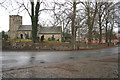
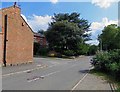
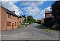
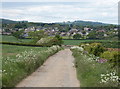
Photos of Thurcaston


Area Information
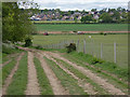
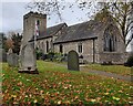
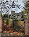
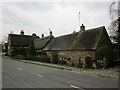
Thurcaston is a compact built-up area in England, covering 42.5 hectares. Its population, while not explicitly stated, is likely small, given its size, and the median age of 70 suggests a community skewed toward older residents. This area is defined by its proximity to transport networks and retail hubs, making it practical for daily life. Residents benefit from nearby rail stations such as Syston, Sileby, and Barrow upon Soar, as well as metro links like Rothley and Leicester North. The presence of five retail outlets, including Tesco Birstall and Waitrose Little, ensures everyday needs are met without long commutes. While Thurcaston lacks large-scale amenities, its strategic connectivity to surrounding towns balances convenience with a quieter, more residential character. For buyers, this area offers a blend of stability and accessibility, ideal for those prioritising ease of movement and proximity to essential services.
- Area Type
- Built Up Area 250
- Area Size
- 42.5 hectares
- Population
- Not available
- Population Density
- Not available
Residents of Thurcaston have access to a range of amenities within walking or short driving distance. Retail options include Tesco Birstall, Waitrose Little, and Budgens Beaumont, providing essentials and convenience. The area’s rail stations and metro links, such as Rothley and Great Central Railway, offer easy access to nearby towns and leisure opportunities. While the data does not mention parks or recreational spaces, the presence of multiple retail and transport hubs suggests a lifestyle focused on practicality and connectivity. The mix of shops, dining, and transport options supports a self-sufficient daily routine, though those seeking extensive green spaces may need to look further afield.
Amenities
Schools
The nearest school to Thurcaston is Richard Hill Church of England Primary School, which serves the area with a primary education offering. Its Ofsted rating is listed as ‘satisfactory’, indicating it meets basic standards but may not excel in all areas. Families relying solely on this school would need to consider secondary education options elsewhere, as no secondary schools are mentioned in the data. The presence of a single primary school suggests a limited choice for parents, though its satisfactory rating ensures a baseline of educational quality. For those prioritising school proximity, Thurcaston’s access to this institution is a practical advantage, though additional research would be needed for comprehensive schooling needs.
| Rank | School | Type | Entry gender | Ages |
|---|
Explore more schools in this area
Go to Schools tabDemographics
Thurcaston’s population has a median age of 70, indicating a community predominantly composed of older adults. Home ownership is high, with 85% of households owning their homes, suggesting a stable, long-term resident base. The data does not specify household composition or ethnic diversity, but the ‘total’ category for these fields implies a lack of detailed breakdowns. The area’s age profile may influence local services and amenities, with a focus on healthcare and community support. While no deprivation data is provided, the high home ownership rate and low crime risk suggest a relatively secure environment. However, the absence of specific figures on diversity or household types limits a deeper understanding of the community’s social fabric.
Household Size
Accommodation Type
Tenure
Ethnic Group
Religion
Household Composition
Age
Household Deprivation
NS-SEC
Explore more demographic insights in this area
Go to Demographics tabPlanning
Planning Constraints
- Crime RiskPremium