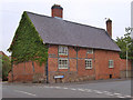
Area Overview for Thrussington
Photos of Thrussington


Area Information
Thrussington is a compact built-up area spanning 30.8 hectares, nestled in England. Its character is defined by a mature population, with a median age of 70, suggesting a community rooted in stability and long-term residency. The area is well-served by essential amenities, including a primary school with a good Ofsted rating and multiple retail options such as Morrisons and M&S. Rail and metro connections, including Sileby and Syston stations, provide accessible transport links to nearby towns. Broadband quality is near flawless, with a score of 99, ensuring seamless connectivity for remote work or leisure. While the area’s demographic profile skews older, its infrastructure and services cater to a range of needs, making it a practical choice for those seeking a low-crime, well-connected neighbourhood with a strong sense of community.
- Area Type
- Built Up Area 250
- Area Size
- 30.8 hectares
- Population
- Not available
- Population Density
- Not available
Thrussington’s lifestyle is shaped by its proximity to retail, transport, and leisure options. The area’s retail scene includes Morrisons Daily and M&S Branston BP, offering everyday shopping needs within easy reach. Rail and metro stations, such as Sileby and Rothley, provide access to wider networks, while the Great Central Railway and Quorn & Woodhouse lines suggest opportunities for scenic travel or commuting. Though the data does not mention parks or recreational spaces, the presence of multiple retail and transport hubs indicates a practical, convenience-focused lifestyle. The area’s amenities cater to daily living, with a focus on accessibility and connectivity rather than expansive leisure facilities.
Amenities
Schools
The primary education in Thrussington is provided by the Thrussington Church of England Primary School, which holds a good Ofsted rating. This single school serves the area’s children, offering a locally based option for families. The absence of secondary schools in the data means that students may need to travel to nearby towns for further education. The school’s good rating suggests a focus on quality teaching and facilities, which is a positive for families prioritising local schooling. However, the limited range of educational institutions in the immediate area means that parents should consider the broader catchment area when assessing the school’s suitability for their needs.
| Rank | School | Type | Entry gender | Ages |
|---|
Explore more schools in this area
Go to Schools tabDemographics
Thrussington’s population is predominantly older, with a median age of 70, reflecting a community where long-term residency is common. Home ownership is high, at 84%, indicating a stable housing market and a preference for property as an investment. The data does not specify household composition or accommodation types, but the high ownership rate suggests a mix of owner-occupied homes, likely including family residences and retirement properties. The area’s demographic profile, while lacking detailed diversity metrics, implies a cohesive, possibly homogenous community. The absence of specific figures on deprivation or ethnic groups means these aspects remain unexplored in the data, but the overall picture points to a mature, settled population with established ties to the area.
Household Size
Accommodation Type
Tenure
Ethnic Group
Religion
Household Composition
Age
Household Deprivation
NS-SEC
Explore more demographic insights in this area
Go to Demographics tabPlanning
Planning Constraints
- Crime RiskPremium