Area Overview for Thorpe Langton
Photos of Thorpe Langton

Area Information
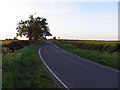
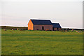
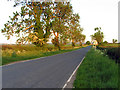
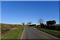
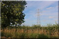
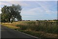
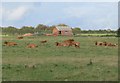
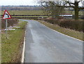
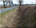
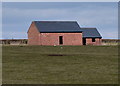
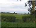
Thorpe Langton is a distinct civil parish covering a compact area of 4.2 square kilometres in England. Living in Thorpe Langton means residing in a settlement defined by its specific boundaries rather than sprawling suburban expansion. The character of the parish is shaped largely by an older demographic, creating a quiet and established residential environment. You will find a community where life moves at a steady pace, typical of a rural parish where proximity to neighbours often relies on foot or cycle rather than motor transport. This location offers a specific type of homes in Thorpe Langton that reflects centuries of settlement rather than recent development waves. The small size of the parish contributes to a localised nature where daily errands remain within a short distance. While the area lacks the wide access roads of a major town, its manageable scale means you can explore the entire parish without needing a vehicle for basic tasks. This setting provides a clear alternative to urban living for those seeking a defined neighbourhood without the complexity of larger municipalities. The simplicity of living in Thorpe Langton appeals to buyers who prefer to know exactly where their property lines lie and understand the full extent of their local environment without ambiguity.
- Area Type
- Parish
- Area Size
- 4.2 km²
- Population
- Not available
- Population Density
- Not available
Demographics
The community in Thorpe Langton presents a clear demographic profile centred on older residents. Eighty-three per cent of people here own their homes, indicating a deeply established resident base. Home ownership levels of 83% suggest that moving to Thorpe Langton usually involves purchasing an existing property rather than entering a rental market. The medians age of the population sits at 70 years, reflecting a community dominated by retirees or older generations. This age distribution shapes the local atmosphere and the types of amenities that matter most to current and future buyers. Household composition and ethnicity data point to a homogenous demographic structure, which often appeals to those seeking a traditional neighbourhood feel. The high rate of home ownership compared to national averages reinforces the idea that Thorpe Langton functions as a retirement destination or a preferred location for families down-sizing to lighter lifestyles. You can expect a stable population where families often stay for decades. The lack of younger age group dominance explains why the area lacks the noise andpace of student districts. When considering schools near Thorpe Langton, you must factor in that the local catchment area serves a population with limited young dependents. This demographic reality affects local business openings and public transport frequency. The demographic make-up ensures that when you buy a home, you are joining a group of self-funded residents who value stability over frequent turnover.
Household Size
Accommodation Type
Tenure
Ethnic Group
Religion
Household Composition
Age
Household Deprivation
NS-SEC
Explore more demographic insights in this area
Go to Demographics tabPlanning
Planning Constraints
- Flood RiskPremium
- Ramsar Wetland SitesPremium
- Area of Outstanding Natural BeautyPremium
- Protected Nature ReservePremium
- Protected WoodlandPremium
- Crime RiskPremium