Area Overview for Thompsons Ward
Photos of Thompsons Ward


Area Information
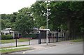
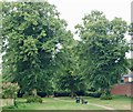
Living in Thompsons Ward offers a specific set of characteristics defined by its geography and safety profile. This district borough unitary ward covers 95.3 hectares, creating a defined spatial environment for residents. You will find a community situated within England without the constraints of major protected landscapes. The area passes all planning constraint checks, meaning there is no Ramsar wetland coverage, no Area of Outstanding Natural Beauty status, and no protected nature reserve or woodland coverage. These clear planning boundaries suggest a more flexible approach to local development compared to restricted conservation zones. For anyone considering Thompsons Ward, the physical footprint is distinct. The 95.3 hectare size provides a tangible sense of scale for the neighbourhood you might pursue. Your daily life here is underpinned by a reassuring environment. The absence of flood risk allows for greater property stability, while the lack of ecological constraints removes typical hurdles faced by buyers in conservation areas. You can expect a standard administrative framework as a unitary ward drives local governance. This setting avoids the complexity of overlapping protected statuses that might complicate future renovations or extensions. The simplicity of the area's description points to a straightforward living situation where administrative processes are likely clear.
- Area Type
- District Borough Unitary Ward
- Area Size
- 95.3 hectares
- Population
- Not available
- Population Density
- Not available
Demographics
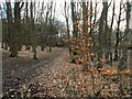
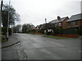
The community character of Thompsons Ward is shaped by its environmental alignment and safety record. While specific census data on age or household composition is not detailed in this report, the ward's structure provides a clear framework for understanding the local environment. The area passes assessment for low-risk categories, including flood risk and Ramsar wetland sites. This indicates a stable land base that supports a functioning local population. The fact that the land does not fall under protected nature reserve or woodland categories means the immediate surroundings are not restricted by heavy ecological guidelines. Safety is a defining feature of the local demographic experience. With a crime risk score of 89 out of 100, the neighbourhood presents a below-average crime rate. This figure translates to a practical lower risk for families or individuals moving to Thompsons Ward. A safety score this high suggests that居民的 daily routine is largely unimpeded by security concerns. The ward status implies a level of administrative cohesion that often correlates with community engagement. You live in an area where the primary environmental concern is not natural hazard or strict conservation rules. Instead, the community benefits from a clear zoning status that distinguishes it from highly protected rural enclaves. The balance of open land and low administrative friction creates a mature demographic profile suitable for steady growth.
Household Size
Accommodation Type
Tenure
Ethnic Group
Religion
Household Composition
Age
Household Deprivation
NS-SEC
Explore more demographic insights in this area
Go to Demographics tabPlanning
Planning Constraints
- Flood RiskPremium
- Ramsar Wetland SitesPremium
- Area of Outstanding Natural BeautyPremium
- Protected Nature ReservePremium
- Protected WoodlandPremium
- Crime RiskPremium