Area Overview for Theddlethorpe All Saints
Photos of Theddlethorpe All Saints
Area Information
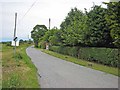
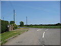
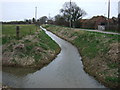
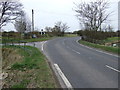
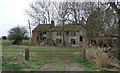
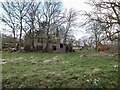
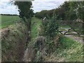
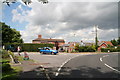
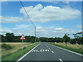
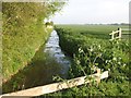
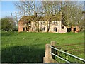
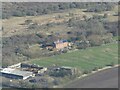
Theddlethorpe All Saints is a civil parish situated in Lincolnshire, covering an area of 9.3 square kilometres. This locality functions as a distinct community within the wider region, offering a specific rhythm of daily life for its residents. The parish remains a relatively small footprint compared to larger urban settlements, which often shapes the scale of local services and the closeness of neighbourly interaction. Living in Theddlethorpe All Saints means navigating an environment defined by its rural character and established housing stock. The area stands as a self-contained unit where the population operates within local boundaries rather than a sprawling metropolitan sprawl. Prospective buyers looking for homes in Theddlethorpe All Saints will encounter a setting that prioritises established residential patterns over rapid modern development. The geographic size suggests a compact community, likely walking distance for many daily activities within the parish limits. You will find yourself in a location that balances the quietude of the countryside with the functional needs of modern residents. This parish represents a traditional model of English local governance, where the community centre and its facilities play a central role in social cohesion. The town's identity is rooted in its history as a civil parish, providing a stable backdrop for those seeking to settle down. Your experience here will be defined by the tangible constraints and comforts of a defined 9.3 km² landscape.
- Area Type
- Parish
- Area Size
- 9.3 km²
- Population
- Not available
- Population Density
- Not available
Demographics
The community profile of Theddlethorpe All Saints reveals a highly settled population with a clear demographic focus. The median age for residents is 70 years, which indicates a retirement community where older adults form the core of the population. You will find that the majority of households are occupied by seniors rather than young families or students moving into the area. Home ownership is exceptionally high in this parish, with 84 percent of dwellings held by owners rather than tenants. This statistic underscores a neighbourhood where long-term residents have purchased their homes and intend to remain. The high rate of ownership suggests stability, as these homeowners are less likely to move compared to renters. Accommodation types reflect this ownership model, with the stock tailored to the needs of an ageing population. The area does not show significant ethnic diversity in its primary demographic data, pointing to a homogenous community with established local roots. Religious composition follows similar traditional patterns expected in a parish of this age profile. Living in Theddlethorpe All Saints means being part of a demographic where life stages are later and housing tenure is secure. You are purchasing into an area where the demographic makeup is skewed decisively towards older, owner-occupied households. This lack of transient renting populations creates a very specific social fabric, distinct from mixed-age urban boroughs. The age distribution and ownership rates together define a retirement-focused locale.
Household Size
Accommodation Type
Tenure
Ethnic Group
Religion
Household Composition
Age
Household Deprivation
NS-SEC
Explore more demographic insights in this area
Go to Demographics tabPlanning
Planning Constraints
- Flood RiskPremium
- Ramsar Wetland SitesPremium
- Area of Outstanding Natural BeautyPremium
- Protected Nature ReservePremium
- Protected WoodlandPremium
- Crime RiskPremium