Area Overview for The Saints Ward
Photos of The Saints Ward
Area Information
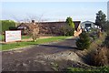
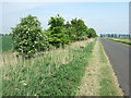
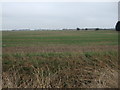
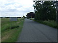
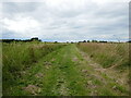
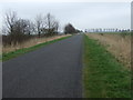
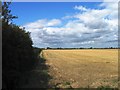
Living in The Saints Ward offers a distinctly rural experience within South Holland District Council. This electoral ward sits in East Midlands England, covering a total area of 42.7 square kilometres. The location is situated in rural Lincolnshire, distinct from nearby urban centres like Peterborough or Stamford. You are approximately positioned at coordinates 52.7065°N, 0.0252°E, placing you deep within the countryside rather than on the edge of a major town. The ward comprises 4,274 hectares of land, making up 5.76% of the entire district. Daily life here revolves around the quiet rhythms of the Lincolnshire countryside. The landscape is defined by open spaces and local governance under South Holland District. Residents benefit from being part of a recognised ward structure which often facilitates local decision-making and representation. The area is separated from larger population hubs, ensuring a peaceful environment. You gain access to the natural setting of the district without the immediate noise of city living. This setting appeals to those seeking separation from urban density while remaining within the administrative framework of the East Midlands. The Saints Ward provides a defined geographical identity for anyone choosing to call this specific electoral division their home.
- Area Type
- District Borough Unitary Ward
- Area Size
- 42.7 km²
- Population
- Not available
- Population Density
- Not available
Demographics
The community within The Saints Ward is defined by a very specific age profile. The median age across this ward stands at 70 years. This statistic indicates a population largely composed of older adults and retirees. The available data does not specify the most common age range in numerical brackets, but the median figure clearly points to a settled, mature demographic. You will find that families with young children are less prevalent compared to areas with younger medians. Household composition and predominant ethnic group data are not explicitly detailed in the provided figures, so the specific breakdown of family types and cultural diversity remains unquantified here. Home ownership is a dominant feature of life in The Saints Ward. A staggering 79% of residents own their homes. This high rate suggests a stable, long-term settlement pattern. Most people in this ward have stayed for decades rather than renting on short-term contracts. The high ownership figure means that when you consider homes in The Saints Ward, you are likely dealing with private owners rather than landlord tenants. You will find few rental listings relative to the total stock. The lack of specific data on deprivation indices means we cannot quantify economic inequality, but the ownership rate signals financial security for the majority. Living in The Saints Ward involves buying into a community where neighbours often have lived through multiple property market cycles.
Household Size
Accommodation Type
Tenure
Ethnic Group
Religion
Household Composition
Age
Household Deprivation
NS-SEC
Explore more demographic insights in this area
Go to Demographics tabPlanning
Planning Constraints
- Flood RiskPremium
- Ramsar Wetland SitesPremium
- Area of Outstanding Natural BeautyPremium
- Protected Nature ReservePremium
- Protected WoodlandPremium
- Crime RiskPremium