Area Overview for The Moultons
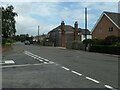
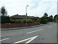
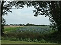
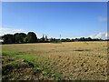
Photos of The Moultons


Area Information
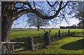
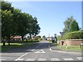
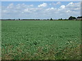
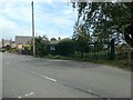
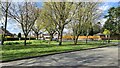
Living in The Moultons means inhabiting a civil parish defined by its quiet rural character and significant size. This community spans 48.7 km², offering residents ample open space and a sense of isolation from the denser urban centres of Norfolk. The landscape here is defined by its openness, free from the planning constraints of areas of outstanding natural beauty or protected woodlands. Daily life revolves around a slower pace, with a strong emphasis on home ownership rather than renting. You will find a neighbourhood where residents value stability and established roots over rapid development. The area stands apart from typical suburban sprawl, presenting a distinct experience for those seeking a property in this specific part of England. Your environment will be characterised by wide-open skies and a clear separation from the hustle of larger towns, suiting individuals who prioritise space and tranquility in their home environment.
- Area Type
- Parish
- Area Size
- 48.7 km²
- Population
- Not available
- Population Density
- Not available
Demographics
The community within The Moultons is distinctly older, with a median age of 70 years. This demographic profile suggests a resident base that is well into retirement rather than a young family demographic seeking to raise children in the parish. You are looking at a neighbourhood where the total population skews heavily towards the senior age brackets. Despite the age composition, the area maintains a strong sense of permanence, evidenced by a house ownership rate of 78%. This high figure indicates that most homes in The Moultons are permanently established in their owners' hands rather than being part of the fluctuating rental market. The household composition reflects this maturity, with fewer shared houses or student accommodations compared to younger-centric areas. The accommodation type data aligns with this picture of established domestic stability. If you consider yourself a buyer, you join a group of people who have invested in their local homes with long-term security in mind.
Household Size
Accommodation Type
Tenure
Ethnic Group
Religion
Household Composition
Age
Household Deprivation
NS-SEC
Explore more demographic insights in this area
Go to Demographics tabPlanning
Planning Constraints
- Flood RiskPremium
- Area of Outstanding Natural BeautyPremium
- Protected WoodlandPremium