Area Overview for Tetford
Photos of Tetford
Area Information
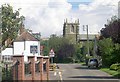
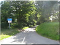
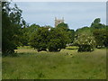
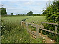
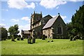
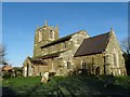
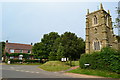
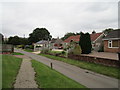
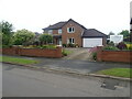
Tetford is a small built-up area in England covering 21.3 hectares, offering a compact, well-defined living environment. With a median age of 70, the community here is predominantly older, reflecting a demographic profile that prioritises stability and familiarity. The area’s modest size means amenities and services are closely clustered, making daily life convenient for residents. Home ownership is high, with 79% of households owning their properties, suggesting a long-term commitment to the area. Living in Tetford is characterised by a quiet, established atmosphere, where the pace of life is slower compared to larger urban centres. The area’s proximity to nearby towns and villages likely provides access to broader services, though its own amenities are limited to essential retail and local facilities. For those seeking a low-maintenance lifestyle with a strong sense of community, Tetford’s demographic and spatial characteristics make it a distinct choice. The area’s safety profile, with a crime risk score of 92, further reinforces its appeal for families and retirees looking for security and peace of mind.
- Area Type
- Built Up Area 250
- Area Size
- 21.3 hectares
- Population
- Not available
- Population Density
- Not available
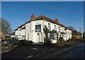
Residents of Tetford have access to a small but functional selection of retail amenities within practical reach. The nearest shops include Spar, Co-op Horncastle, and another Spar, providing basic grocery and convenience services. These outlets suggest a focus on everyday needs rather than specialist retail, aligning with the area’s older demographic. The absence of data on dining, parks, or leisure facilities means the full range of lifestyle options is not detailed. However, the proximity of these shops implies a community-oriented environment where local commerce plays a central role. For those prioritising convenience, the retail offerings in Tetford support a self-contained lifestyle, though broader amenities would require travel to nearby towns. The character of the area is likely shaped by these small-scale services, reinforcing a sense of local identity.
Amenities
Schools
| Rank | A + A* % | School | Type | Entry gender | Ages |
|---|
Explore more schools in this area
Go to Schools tabDemographics
The population of Tetford has a median age of 70, indicating a community that is largely composed of older adults. This age profile suggests a demographic that may prioritise accessibility, healthcare services, and social cohesion. The home ownership rate of 79% highlights a strong presence of long-term residents, many of whom may have lived in the area for decades. The data does not specify household composition or accommodation types, but the high ownership percentage implies a stable, less transient population. The predominant ethnic group and religious composition are not detailed, but the figures provided suggest a homogenous community. For quality of life, the age profile may influence local services, such as healthcare and leisure facilities tailored to older adults. The absence of specific diversity metrics means the area’s cultural and social dynamics are not quantified in the data.
Household Size
Accommodation Type
Tenure
Ethnic Group
Religion
Household Composition
Age
Household Deprivation
NS-SEC
Explore more demographic insights in this area
Go to Demographics tabPlanning
Planning Constraints
- Crime RiskLocked