Area Overview for Temple Normanton
Photos of Temple Normanton
Area Information
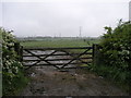
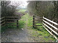
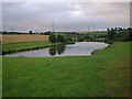
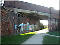
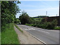
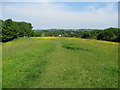
Temple Normanton is a small civil parish covering an area of 2.3 km², situated in England. Living in Temple Normanton means residing in a compact community where space is defined by its modest footprint rather than sprawling developments. The location is established and self-contained, offering a clear picture of daily life for residents who value a defined neighbourhood without the noise of rapid urban expansion. Prospective buyers considering homes in Temple Normanton should be prepared for a setting where the built environment fits tightly within its geographical bounds. This concentration creates a sense of locality, yet it also implies limited room for new large-scale housing estates. When you evaluate living in Temple Normanton, remember that the area size restricts the variety of street scenes you might encounter compared to larger towns. You are buying into a fixed environment where the character of the village is already set by existing structures. The parish format suggests a degree of administrative independence that often correlates with local governance focused on preserving nature and infrastructure within these specific boundaries. Understanding the scale of 2.3 km² helps you visualise how far you might need to travel for services not immediately present in the parish itself.
- Area Type
- Parish
- Area Size
- 2.3 km²
- Population
- Not available
- Population Density
- Not available
Demographics
The community in Temple Normanton is highly mature, with a median age of 70 years. This demographic profile indicates that the majority of the population consists of older adults, making it a retirement-oriented or semi-retirement settlement. When you consider the age structure, you are joining an area where life moves at a slower pace, distinct from younger urban centres. Household composition reflects this standard, though specific breakdowns by family type are not detailed in current records. Similarly, information on predominant ethnic groups or religious affiliations is not currently available for this specific parish, so the community appears culturally uniform based on age. Home ownership is a defining feature of the area, with 83% of residents owning their homes. This high rate of ownership suggests deep-rooted families who have stayed put for generations, creating stability but potentially limiting availability for first-time buyers. The remaining 17% may rent or live in shared ownership arrangements. Accommodation data categories exist for total averages, highlighting that the housing stock is designed primarily for long-term living rather than transient use. Living here means you are part of a neighbourhood selected by those seeking stability, quiet surroundings, and freedom from the pressures of a young, rental-dominated market.
Household Size
Accommodation Type
Tenure
Ethnic Group
Religion
Household Composition
Age
Household Deprivation
NS-SEC
Explore more demographic insights in this area
Go to Demographics tabPlanning
Planning Constraints
- Flood RiskLocked
- Ramsar Wetland SitesLocked
- Area of Outstanding Natural BeautyLocked
- Protected Nature ReserveLocked
- Protected WoodlandLocked
- Crime RiskLocked