Area Overview for Temple Bruer with Temple High Grange
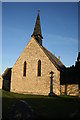
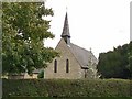
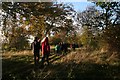
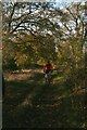
Photos of Temple Bruer with Temple High Grange
Area Information
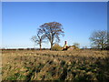
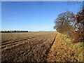
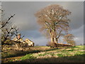
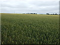
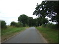
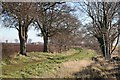
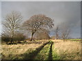
Living in Temple Bruer with Temple High Grange offers a quiet experience within a civil parish that spans 15.3 km². This small community sits in England and operates as a distinct local unit where daily life moves at a deliberate pace. You will find that the area is defined by its rural nature rather than urban development. The scale of the parish suggests a neighbourhood where residents often know one another, creating a focused environment away from the noise of larger towns. When you are looking for homes in Temple Bruer with Temple High Grange, you are entering a space that prioritises space and tranquillity over dense convenience. The geography of this 15.3 km² area means that distances between properties can feel significant, reinforcing the secluded character of life here. Prospective buyers should understand that this is a place where the landscape shapes your routine rather than a busy transport network doing so. The distinct identity of Temple Bruer with Temple High Grange makes it suitable for those who value a clear break from city life. You will not find the intensity of metropolitan centres but instead a setting where the horizon remains unobstructed by tall buildings.
- Area Type
- Parish
- Area Size
- 15.3 km²
- Population
- Not available
- Population Density
- Not available
Demographics
The community in Temple Bruer with Temple High Grange is defined by an older population profile. Your demographic reality will centre on residents with a median age of 70. This figure indicates that the average person in this parish has reached retirement age, meaning you will encounter a generation that has lived through significant changes in local infrastructure. Most common age statistics confirm that the age distribution skews heavily towards seniors, changing how public spaces are used during the day and evening. Home ownership stands at 76%, a substantial majority that suggests most people have bought their current property rather than renting. This high rate of home ownership typically correlates with long-term settlement and a lack of transient population turnover. When you consider living in Temple Bruer with Temple High Grange, you join a stable group where many families have remained for decades. Household composition analysis supports this picture of stability, showing that residents often have multiple generations or take on a caretaker role within the neighbourhood. The lack of complex diversity data suggests a community that has remained somewhat homogenous over time. If you are looking at schools near Temple Bruer with Temple High Grange, be aware that the local population structure reflects a retirement-focused area rather than a bring-up zone for young children.
Household Size
Accommodation Type
Tenure
Ethnic Group
Religion
Household Composition
Age
Household Deprivation
NS-SEC
Explore more demographic insights in this area
Go to Demographics tabPlanning
Planning Constraints
- Flood RiskPremium
- Ramsar Wetland SitesPremium
- Area of Outstanding Natural BeautyPremium
- Protected Nature ReservePremium
- Protected WoodlandPremium
- Crime RiskPremium