Area Overview for Tathwell
Photos of Tathwell
Area Information
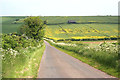
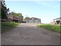
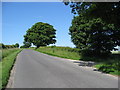
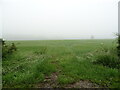
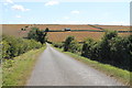
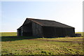
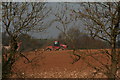
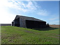
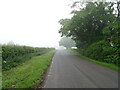
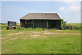
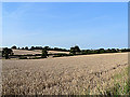
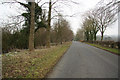
Tathwell is a small civil parish covering an area of 17.6 square kilometres in rural England. Living in this location means experiencing a distinctly quiet life far removed from the pace of larger towns. The landscape is defined by its vast open spaces and designated protected areas. You will find that much of the land falls within an Area of Outstanding Natural Beauty, which dictates planning rules and restricts development. Parts of the parish also contain protected woodland, further limiting where new homes or commercial buildings can be constructed. This combination of environmental designations creates a serene setting but requires careful consideration if you are looking to build or extend. The area lies in a region where the population has largely settled into long-term locations rather than moving frequently. Daily life revolves around local amenities rather than urban centres, given the limited transport links. For those seeking a retired lifestyle or a permanent country home, Tathwell offers stability. However, a potential buyer must accept that the strict conservation status of the area shapes every aspect of property ownership. You are living in an environment where nature protection takes precedence over construction expansion.
- Area Type
- Parish
- Area Size
- 17.6 km²
- Population
- Not available
- Population Density
- Not available
Demographics
The community in Tathwell is characterised by an exceptionally older population. The median age stands at 70 years, reflecting a neighbourhood where retirees and older residents form the core demographic. Household composition naturally aligns with this age profile, favouring single-person households or couples in retirement rather than families with young children. Home ownership is the dominant arrangement in the parish, with 70% of homes owned outright by their occupants. This high rate of ownership suggests residents have deep roots in the community and are unlikely to move quickly. Despite the focus on older demographics, you should be aware that specific ethnic diversity figures and religious affiliation data are not provided for this parish. The available information highlights a homogenous community driven by age and ownership status rather than transient factors. There are no mixed-age housing estates or student populations to dilute the quiet character of the village. The atmosphere is consistent with a retirement haven where neighbours know each other well. If you are considering homes in Tathwell, expect to join a settled group living in similar circumstances.
Household Size
Accommodation Type
Tenure
Ethnic Group
Religion
Household Composition
Age
Household Deprivation
NS-SEC
Explore more demographic insights in this area
Go to Demographics tabPlanning
Planning Constraints
- Flood RiskPremium
- Ramsar Wetland SitesPremium
- Area of Outstanding Natural BeautyPremium
- Protected Nature ReservePremium
- Protected WoodlandPremium