Area Overview for Syresham
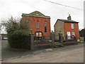
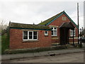
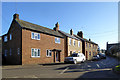
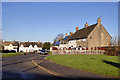
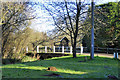
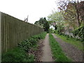
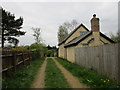
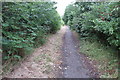
Photos of Syresham
Area Information
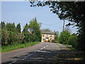
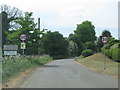
Living in Syresham offers a quiet, established presence in England’s built-up areas. Covering 35.9 hectares, it is a compact community where 80% of residents own their homes. The area’s median age of 70 suggests a population skewed towards older adults, creating a distinct demographic profile. Syresham’s safety is a key draw, with a crime risk score of 83 — a pass — indicating below-average crime rates. Nearby, Turweston Airport provides direct access to regional travel, while five retail outlets, including Sainsburys Brackley and M&S Brackley BP, offer everyday convenience. This is a place where practicality meets stability, with a focus on accessibility and low risk. For those seeking a calm, well-connected environment, Syresham’s blend of safety, local amenities, and straightforward living makes it a compelling choice.
- Area Type
- Built Up Area 250
- Area Size
- 35.9 hectares
- Population
- Not available
- Population Density
- Not available
Residents of Syresham have access to a range of practical amenities within easy reach. The Turweston Airport provides direct travel options, while five retail outlets, including M&S Brackley BP and Sainsburys Brackley, offer shopping and daily essentials. These facilities contribute to a lifestyle that prioritises convenience and accessibility. Although the data does not mention parks or leisure spots, the presence of nearby retail and transport hubs suggests a focus on functional living. The area’s compact size means amenities are not distant, supporting a routine that blends local needs with regional connectivity. For those valuing proximity to services, Syresham’s amenities deliver a straightforward, efficient lifestyle.
Amenities
Schools
The nearest school to Syresham is Syresham St James CofE Primary School and Nursery, a primary institution with a good Ofsted rating. This school serves the local community, offering education for younger children. The absence of secondary schools in the data suggests families may need to look beyond Syresham for secondary education, though the primary school’s quality is a positive for those prioritising early learning. The single school listed indicates a limited range of educational options, which could be a consideration for families requiring multiple schooling tiers. However, the good rating at the primary level provides reassurance for parents seeking reliable early education.
| Rank | School | Type | Entry gender | Ages |
|---|
Explore more schools in this area
Go to Schools tabDemographics
Syresham’s population is predominantly older, with a median age of 70 and the most common age range encompassing all age groups. Home ownership is high at 80%, reflecting a community where most residents live in properties they own. The data does not specify household composition or diversity, but the figures for predominant ethnic group and religion are listed as totals, suggesting a lack of detailed breakdowns. This implies a relatively homogeneous population in terms of background and beliefs. The absence of specific data on deprivation or socioeconomic factors means the area’s quality of life can only be inferred from its safety and infrastructure. For buyers, the high home ownership rate and older demographic suggest a stable, low-turnover market.
Household Size
Accommodation Type
Tenure
Ethnic Group
Religion
Household Composition
Age
Household Deprivation
NS-SEC
Explore more demographic insights in this area
Go to Demographics tabPlanning
Planning Constraints
- Crime RiskPremium