Area Overview for Syerston
Photos of Syerston


Area Information
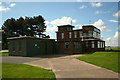
Syerston is a built-up area in England covering 75 hectares. This neighbourhood functions as a distinct residential community within the broader East Midlands region. You will find that daily life here revolves around a stable, established environment rather than rapid change. The area provides a settled atmosphere for those seeking a clear domestic base without the chaos of major urban centres. Living in Syerston means accessing a self-contained locality where the physical boundaries are defined by its classification as a town or city fringe. The scale is manageable, offering residents a sense of exposure to nature while maintaining easy access to surrounding services. You move through an area where the built environment has remained consistent over time. This consistency prevents the unpredictability often found in rapidly developing estates. The landscape is utilised for living rather than commercial density. Homes sit within a framework that has served families for decades. When you consider homes in Syerston, you are looking at a location defined by its role as a local hub rather than a satellite town dependent on a distant centre. The area size allows for sufficient space between properties while keeping essential facilities within a short walking or driving distance. Your view of Syerston should be one of practical living where the neighbourhood defines your world without overwhelming your schedule.
- Area Type
- Built Up Area 250
- Area Size
- 75.0 hectares
- Population
- Not available
- Population Density
- Not available
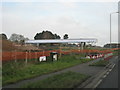
Access to amenities in Syerston is practical but requires travel to specific nodes. Five railway stations are within practical reach, including Bleasby Railway Station, Thurgarton Railway Station, and Fiskerton Railway Station. You can access rail links to broader networks without a long drive. Local retail options are concentrated at key points like Budgens Gonalston and Spar. M&S Southwell Green BP also serves the community with goods and fuel. These five retail outlets provide daily essentials without the need to drive far. You will manage your grocery shopping and household items through these specific venues. The area lacks a large high street but relies on these scattered points for convenience. Dining and leisure facilities are not explicitly named in the immediate inventory, so you must plan outings to nearby towns. The character of daily life involves a drive to visit larger shopping centres for non-essential goods. Your morning coffee and lunch may come from the nearby Spar or Budgens. The five known amenities form a functional hub that keeps the streets clean and active. Residents appreciate the proximity to rail hubs for weekend trips. The lifestyle here is defined by the necessity of planned travel for retail therapy while enjoying local services. This arrangement suits residents who do not require constant immediate entertainment. You live near the essential services that keep the household running efficiently.
Amenities
Schools
| Rank | School | Type | Entry gender | Ages |
|---|
Explore more schools in this area
Go to Schools tabDemographics
The community profile in Syerston reveals a high median age of 70 years. This figure indicates that the residents are significantly older than the national average. Most households consist of individuals or couples who have remained in their homes long term. The demographic data shows a total age distribution concentrated towards the upper end of the lifespan. You will find a population rooted in this locality rather than transient workers. Home ownership stands at 82 per cent across the area. This high rate confirms that the majority of residents have purchased their properties and are living there permanently. The household composition data reflects families and single occupants aged 60 and over. Accommodation types in Syerston align with this older demographic through long-standing stock rather than new builds. There are 820 owners for every 100 renters in the area. Ethnic diversity is represented by a total population mix, though specific predominant groups are not itemised in the current breakdown. Religion data is similarly presented as a total figure without specific denominational breakdowns. This demographic structure means the area is quieter during working hours and retains a traditional neighbourhood character. Quality of life for older residents is supported by lower crime risks. The age profile explains the high rate of home ownership and a stable community fabric.
Household Size
Accommodation Type
Tenure
Ethnic Group
Religion
Household Composition
Age
Household Deprivation
NS-SEC
Explore more demographic insights in this area
Go to Demographics tabPlanning
Planning Constraints
- Crime RiskPremium