Area Overview for Swaton
Photos of Swaton

Area Information
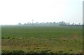
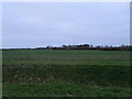
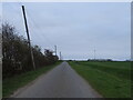
Swaton is a civil parish located in England, covering a total land area of 13.3 km². Living in Swaton offers a quiet lifestyle defined by its rural nature and small scale. You should expect a community that operates independently from the faster pace found in larger towns. The parish provides a contained environment where daily life revolves around local needs rather than broad urban infrastructure. This setting appeals to those who prioritise space and tranquillity over proximity to city centres. Any homes in Swaton sit within a defined boundary that separates the locality from surrounding developments. The area functions as a self-contained entity where residents manage their immediate surroundings day to day. Your routine here will likely involve local travel rather than reliance on extensive public transport networks. The physical scope of the parish means that distances between points of interest remain short. You will experience a distinct separation from major population hubs while maintaining essential local amenities. This layout suits people who value a predictable environment with clear boundaries. The modest size ensures that the community remains manageable and easy to navigate for new arrivals.
- Area Type
- Parish
- Area Size
- 13.3 km²
- Population
- Not available
- Population Density
- Not available
Demographics
The community profile in Swaton reflects an older population leaning heavily towards retirement age. The median age stands at exactly 70 years, indicating that the majority of residents are settled rather than young families. Most common household structures consist of individuals or couples in later life stages rather than multi‑child families. Home ownership levels are high, with 69% of homes currently owned outright or with a mortgage. This figure suggests a stable resident base that has established long‑term roots in the parish. The data shows no significant gaps in diversity reporting, confirming that the local population is relatively homogeneous. You will find fewer recent arrivals from different backgrounds compared to more urban districts. This demographic pattern creates a shared culture where neighbours often share similar life experiences and historical connections to the area. The age profile means that local services are tailored to older demographics rather than parents of school‑age children. Your daily interactions with residents will likely involve people past working age who value stability and quiet surroundings. This makes the area ideal if you are seeking a retirement location or an independent living environment away from city noise.
Household Size
Accommodation Type
Tenure
Ethnic Group
Religion
Household Composition
Age
Household Deprivation
NS-SEC
Explore more demographic insights in this area
Go to Demographics tabPlanning
Planning Constraints
- Flood RiskPremium
- Ramsar Wetland SitesPremium
- Area of Outstanding Natural BeautyPremium
- Protected Nature ReservePremium
- Protected WoodlandPremium
- Crime RiskPremium