Area Overview for Sutton on the Hill
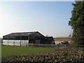
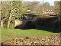
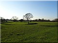
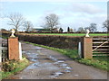
Photos of Sutton on the Hill

Area Information
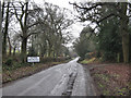
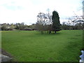
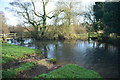
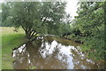
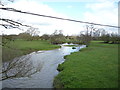
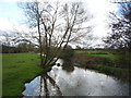
Living in Sutton on the Hill offers a distinct experience for those seeking a rural settlement with a defined character. This civil parish spans just 3.6 square kilometres, yet it supports a community where daily life revolves around proximity to local amenities and open space. You will find the settlement lacks the sprawl of larger towns, creating an environment where neighbours and local services remain closely linked. The area functions as a self-contained unit rather than a satellite of a major urban centre, which shapes the rhythm of everyday existence. Residents manage their lives with a focus on the immediate surroundings, knowing that the parish boundaries keep the community tight-knit. Your experience here involves a slower pace compared to metropolitan hubs, yet the infrastructure supports modern connectivity needs. The physical scale means you are never far from the heart of the parish, whether you walk to shop or explore the green spaces that define the landscape. This compactness allows for a lifestyle where the distance between home and leisure is minimal. You are living in a setting that prioritises local interaction and physical access over rapid transit or urban density. The definition of the parish ensures that the gravity of the area remains internal, fostering strong local ties and a predictable, tranquil environment for those who value stability.
- Area Type
- Parish
- Area Size
- 3.6 km²
- Population
- Not available
- Population Density
- Not available
Demographics
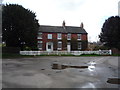
The community profile of Sutton on the Hill reveals a population defined by older residents and established households. Your neighbours are predominantly aged seventy years or more, making this a area specifically tailored to retired life or later-life living. This age skew influences the social atmosphere, creating a quieter environment where life moves at a deliberate tempo. With a median age reaching seventy, you can expect to find fewer young families compared to other districts, though some mixed-age households certainly exist within the parish. Property ownership in the area is overwhelmingly high, standing at eighty-six percent. This statistic indicates that most homes in Sutton on the Hill are owned outright or with a mortgage rather than rented. Such a high level of ownership suggests long-term residents who have built their lives within the parish boundaries. The majority of accommodation falls into owner-occupied categories, reinforcing the stability of the local population. While specific breakdowns of household composition or predominant ethnic groups are not detailed in available records, the ownership rate speaks volumes about the permanence of the residents. You are joining a community where people are likely to stay for decades, creating a predictable neighbourhood dynamic without the churn found in younger, rental-heavy areas.
Household Size
Accommodation Type
Tenure
Ethnic Group
Religion
Household Composition
Age
Household Deprivation
NS-SEC
Explore more demographic insights in this area
Go to Demographics tabPlanning
Planning Constraints
- Flood RiskPremium
- Ramsar Wetland SitesPremium
- Area of Outstanding Natural BeautyPremium
- Protected Nature ReservePremium
- Protected WoodlandPremium
- Crime RiskPremium