Area Overview for Sutton Junction & Harlow Wood Ward
Photos of Sutton Junction & Harlow Wood Ward
Area Information
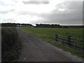
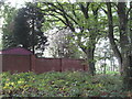
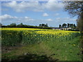
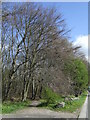
Sutton Junction & Harlow Wood Ward covers an area of 11.4 km² within the Sutton borough, functioning as a distinct district within this unitary authority. You will find a community centred on well-established suburban streets where the density remains moderate. The ward is characterised by a quiet residential feel, far removed from the high-energy pace found in larger development zones. Living in Sutton Junction & Harlow Wood Ward offers a settled environment defined by long-term stability rather than rapid renewal. The layout supports a neighbourhood lifestyle where local amenities are accessible without the need for extensive commuting within the ward itself. This specific district caters to a demographic that values space and established surroundings over new-build excitement. The boundaries are sharp, creating a self-contained zone for those seeking a particular type of suburban experience. Your daily life here revolves around familiar local routes and a predictable rhythm typical of older residential areas. Prospective buyers looking for a steady, non-volcanic market might find the consistent nature of this ward appealing. The ward does not boast large industrial parks or major retail parks inside its borders, so your focus will remain on the domestic sphere. This section of Sutton presents a straightforward option for families or retirees who prioritise a known and unchanging neighbourhood structure.
- Area Type
- District Borough Unitary Ward
- Area Size
- 11.4 km²
- Population
- Not available
- Population Density
- Not available
Demographics
The community in Sutton Junction & Harlow Wood Ward reflects a mature population profile suited to retirement and established family life. The median age reaches 70, which is exceptionally high compared to the rest of the UK average. This indicates that the ward attracts or retains a significant number of older residents. You will encounter a demographic where Age: Total encompasses almost the entire population spectrum, confirming an older central tendency. Home ownership stands at an impressive 82%, meaning the vast majority of residents own their properties outright or with a mortgage. This high rate suggests stable households with strong financial roots in the area. Household composition and accommodation types are typical of this age demographic, though specific breakdowns are not detailed in the provided records. The lack of a mixed-age population means you will rarely see young children or teenagers playing in the local parks. Predominant ethnic group, religion, and deprivation data are not recorded in the available census information for this specific ward. Consequently, you cannot make assumptions about cultural diversity or socioeconomic challenges based on these missing figures. The population remains relatively homogenous in terms of age, creating a calm social atmosphere. When considering who lives here, you are looking at a neighbourhood dominated by older adults rather than young professionals or students.
Household Size
Accommodation Type
Tenure
Ethnic Group
Religion
Household Composition
Age
Household Deprivation
NS-SEC
Explore more demographic insights in this area
Go to Demographics tabPlanning
Planning Constraints
- Flood RiskPremium
- Ramsar Wetland SitesPremium
- Area of Outstanding Natural BeautyPremium
- Protected Nature ReservePremium
- Protected WoodlandPremium
- Crime RiskPremium