Area Overview for Sutton Central & New Cross Ward
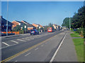
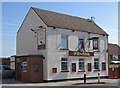
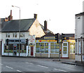
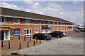
Photos of Sutton Central & New Cross Ward


Area Information
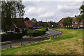
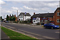
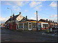
Living in Sutton Central & New Cross Ward offers a compact residential experience defined by its small footprint and dense population. This district borough unitary ward covers only 2.0 km², yet it accommodates 1,904 residents. That density results in approximately 933 people per square kilometre, creating an urban environment where neighbours are likely to know each other through proximity rather than shared social circles. The ward is entirely within England, part of the larger London metropolitan context, operating as a distinct administrative area with clear boundaries. Daily life here involves navigating a space where every square metre counts, meaning local amenities are naturally concentrated to support the high resident count. You can expect a neighbourhood that functions efficiently under pressure, with infrastructure designed to serve a specific number of people within limited physical space. This concentration ensures that services are accessible without the need for long commutes to local shops or community hubs. The ward represents a focused pocket of residential life where the scale of development matches the immediate needs of its population.
- Area Type
- District Borough Unitary Ward
- Area Size
- 2.0 km²
- Population
- 1904
- Population Density
- 933 people/km²
Demographics
The community profile of Sutton Central & New Cross Ward is heavily skewed towards older residents, reflecting a distinct demographic shift across the ward. The median age of 70 years indicates that half of the population is older than this figure, suggesting a retirement-focused or mature demographic. While the data lists the most common age range as Age: Total without further breakdown, the median age clearly signals that families with young children are not the primary demographic here. Home ownership stands at 44%, which is slightly below the national average, indicating that a significant portion of the population rents their homes rather than purchasing them. This ownership split is typical for older residents who may have sold up or moved into affordable retirement housing. Accommodation types and predominant ethnic groups lack specific breakdown figures, but the age data strongly suggests that lifestyle choices regarding housing are driven by retirement needs rather than family expansion. The demographic reality means you are likely to find a quieter, settled community where long-term residents form the backbone of the neighbourhood fabric.
Household Size
Accommodation Type
Tenure
Ethnic Group
Religion
Household Composition
Age
Household Deprivation
NS-SEC
Explore more demographic insights in this area
Go to Demographics tabPlanning
Planning Constraints
- Flood RiskPremium
- Ramsar Wetland SitesPremium
- Area of Outstanding Natural BeautyPremium
- Protected Nature ReservePremium
- Protected WoodlandPremium
- Crime RiskPremium