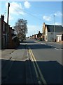
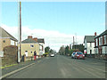
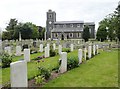
Area Overview for Sutton Bridge
Photos of Sutton Bridge


Area Information
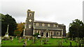
Living in Sutton Bridge means settling into a compact built-up area covering 1.8 km². This small town within England offers a contained environment where daily life revolves around local infrastructure. The area is defined by its size, creating a tight-knit community where residents are often within walking distance of essential localities. There is no population figure explicitly provided for the total number of residents, but the demographic profile suggests a settlement dominated by older adults. The median age here sits at 70, which fundamentally shapes the rhythm of daily life in Sutton Bridge. You will find a quieter atmosphere compared to larger urban centres, with houses designed for established homeowners rather than transient renters. The area feels stable and familiar, lacking the bustling energy of major cities but compensating with a focused, neighbourhood-centric pace. Those considering homes in Sutton Bridge should expect a setting where services and neighbours are immediate. The physical footprint remains modest, ensuring that the town does not sprawl outwards but rather concentrates its character within clear boundaries. This compactness makes it easy to navigate without relying heavily on extensive public transport networks.
- Area Type
- Built Up Area 250
- Area Size
- 1.8 km²
- Population
- Not available
- Population Density
- Not available
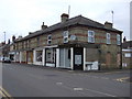
Daily life in Sutton Bridge revolves around a tight circle of local retail and essential services. Within practical reach, you have access to five distinct retail venues to satisfy daily shopping needs. The Lincolnshire Co-operative Co provides comprehensive grocery and household supplies, serving as the primary destination for food shopping. A Spar store is also conveniently located nearby, offering convenience goods for quick trips. Another Lincolnshire Co-operative Co outlet reinforces the availability of established local trade. These facilities ensure that residents do not need to travel far for basic necessities, which is a significant convenience in a small town. Park or leisure facilities are not explicitly named in the data, so your entertainment likely centres around home environments or regional attractions slightly further away. The presence of these specific shops creates a functional lifestyle where errands are localised and manageable. Walking to the Coop or Spar is a realistic daily habit for many households. This cluster of amenities defines the practical rhythm of living in Sutton Bridge, prioritising convenience and locality over sprawling entertainment districts.
Amenities
Schools
Educational options for families in Sutton Bridge are limited by the area's demographic profile and size. The nearest primary education is provided by Sutton Bridge Westmere Community Primary School, which holds a good Ofsted rating. This independent school supports local children who remain in the immediate vicinity for their early schooling. There is also an independent facility named Cottage Crafts nearby, though it does not have an Ofsted rating listed in the available assessment data. The combination of state and independent schooling suggests a mix of funding and curricular approaches, yet the scarcity of educational institutions reflects the small population. There are no secondary schools named in the specific data for this locality, meaning older children likely travel further for education. Families considering boardrooms in Sutton Bridge must be aware that schooling options are specialised and numerically small. The presence of a rated primary school is a positive indicator for younger children, but the lack of secondary or mixed institutions means the area serves as a starting point rather than a full educational destination.
| Rank | School | Type | Entry gender | Ages |
|---|
Explore more schools in this area
Go to Schools tabDemographics
The community in Sutton Bridge is distinctively older than the national average, with a median age of 70 years. This age profile reflects a settlement populated largely by retirees or established long-term residents. Sixty-five per cent of households in this part of England own their homes outright, indicating a strong tradition of property ownership rather than renting. You will rarely encounter a high concentration of student renters or temporary housing arrangements like flats or apartments. Instead, the accommodation type is likely characterised by owned family homes or retirement residences suited to an older demographic. The data does not specify breakdowns for ethnicity or religion, but the homogeneity suggested by the age and ownership figures implies a traditional community structure. This demographic reality influences local services, with facilities often catering to the needs of seniors. Quality of life here is centred on stability and heritage. There is little churn in the neighbourhoods, meaning you are buying into a permanent community rather than a transient population. For those seeking homes in Sutton Bridge, this environment offers peace and continuity, though it may lack the youthful vibrancy found in younger towns.
Household Size
Accommodation Type
Tenure
Ethnic Group
Religion
Household Composition
Age
Household Deprivation
NS-SEC
Explore more demographic insights in this area
Go to Demographics tabPlanning
Planning Constraints
- Crime RiskPremium