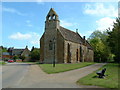
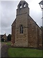
Area Overview for Sutton Bassett
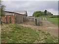
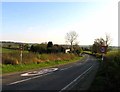
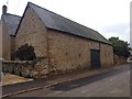
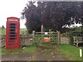
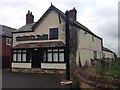
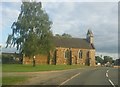
Photos of Sutton Bassett


Area Information
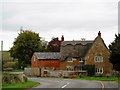
Living in Sutton Bassett means settling in a compact civil parish that covers just 3.0 km² of land in England. This small settlement offers a contained environment where daily trips are manageable and the community remains intimate. You will find a village where the landscape is defined by its modest size rather than sprawling development. The area sits quietly on the outskirts, far from the congestion of major urban centres. For those seeking a quieter life, the small footprint of the parish ensures that you are embedded within a close-knit setting. The population here reflects a distinct demographic character, heavily weighted towards older residents. This concentration shapes the daily rhythm of the village, focusing on established rather than transient living patterns. When you look at the landscape of Sutton Bassett, the infrastructure supports a slower pace of life. The limited geographic scope means that amenities are often within walking distance or a short drive away. This configuration makes the area particularly suitable for retirees who value proximity to their neighbours and a reduced reliance on long-distance commuting. The parish maintains an independent identity while remaining integrated into the wider local network.
- Area Type
- Parish
- Area Size
- 3.0 km²
- Population
- Not available
- Population Density
- Not available
Demographics
The community profile of Sutton Bassett is heavily influenced by its age structure. The median age for residents reaches 70 years, indicating that this is predominantly a retirement or senior living area. Most households fall within the broader adult age categories, reflecting a population that has settled in the village for the long term. This demographic reality dictates the social activities and services available locally. You will find a neighbourhood where generations have grown up together, fostering strong intergenerational bonds. Home ownership stands at an impressive 81% within the parish. This high figure confirms that Sutton Bassett is a location where people buy to stay rather than rent. The vast majority of homes are occupied by their owners, which typically leads to greater investment in property maintenance and pride of ownership. Accommodation types align with this stable population, though specific details on house versus flat distribution are not detailed in the primary figures provided. The high ownership rate suggests a community with deep local roots. Ethnic diversity and religious breakdowns are not explicitly detailed in the available records, but the overall picture points to a homogeneous, settled population. For anyone considering moving here, the evidence points towards a stable, low-turnover residential environment.
Household Size
Accommodation Type
Tenure
Ethnic Group
Religion
Household Composition
Age
Household Deprivation
NS-SEC
Explore more demographic insights in this area
Go to Demographics tabPlanning
Planning Constraints
- Flood RiskPremium
- Ramsar Wetland SitesPremium
- Area of Outstanding Natural BeautyPremium
- Protected Nature ReservePremium
- Protected WoodlandPremium
- Crime RiskPremium