Area Overview for Sturton le Steeple
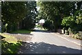
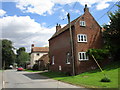
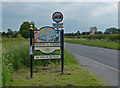
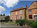
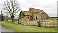
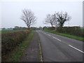
Photos of Sturton le Steeple


Area Information
Sturton le Steeple is a compact built-up area in England, spanning 35.3 hectares. It is home to a population with a median age of 70, suggesting a community skewed toward older residents. The area’s small size means it is likely to feel close-knit, with local amenities and services within easy reach. For those considering living here, the low crime risk—scoring 85 out of 100—adds to its appeal as a safe place to reside. The area’s proximity to Gainsborough and Retford offers access to larger towns without the need for long commutes. Residents benefit from nearby rail links, including Gainsborough Lea Road and Gainsborough Central stations, which connect to regional transport networks. The presence of Sturton CofE Primary School, rated good by Ofsted, makes it a practical choice for families. While the broadband score is low at 23, mobile coverage is strong at 82, ensuring reliable connectivity for communication and basic internet use. Sturton le Steeple’s character is defined by its older demographic, practical infrastructure, and proximity to essential services.
- Area Type
- Built Up Area 250
- Area Size
- 35.3 hectares
- Population
- Not available
- Population Density
- Not available
Daily life in Sturton le Steeple is shaped by its proximity to practical amenities. The area includes four rail stations, offering easy access to regional transport and connecting to larger towns like Gainsborough and Retford. For shopping, residents can visit Aldi Gainsborough, Spar, and Spar Warren, providing access to essentials. While the data does not mention parks or leisure facilities, the rail links and retail options suggest a functional lifestyle focused on convenience. The presence of Sturton CofE Primary School adds to the area’s appeal for families, ensuring children have access to education. The low crime risk and established community further support a stable, low-stress environment. Overall, the lifestyle in Sturton le Steeple balances practicality with the quiet character of a small, mature town.
Amenities
Schools
Sturton le Steeple is served by Sturton CofE Primary School, a primary school rated good by Ofsted. This school is the only one listed in the data, meaning families with young children have access to a single primary education option. The good Ofsted rating indicates that the school meets or exceeds national standards in teaching quality and student outcomes. While no secondary schools are mentioned, the proximity to larger towns like Gainsborough and Retford may provide access to additional educational institutions. The presence of a rated primary school is a key consideration for families, ensuring a baseline of quality education for children. However, those requiring secondary schooling may need to look beyond the immediate area.
| Rank | A + A* % | School | Type | Entry gender | Ages |
|---|---|---|---|---|---|
| 1 | N/A | Sturton CofE Primary School | primary | N/A | N/A |
Explore more schools in this area
Go to Schools tabDemographics
The population of Sturton le Steeple has a median age of 70, the highest in the dataset, indicating a community predominantly composed of older adults. This age profile shapes the area’s social dynamics, with a focus on stability and long-term residency. Home ownership is high at 80%, suggesting that most residents live in properties they own rather than rent. The data does not specify household composition or diversity, but the high home ownership rate implies a settled population. The accommodation types are not detailed, but the overall home ownership percentage points to a market where properties are likely to be family homes or long-term residences. The absence of specific data on deprivation or ethnic diversity means these aspects cannot be assessed, but the existing figures highlight a mature, established community with strong ties to property ownership.
Household Size
Accommodation Type
Tenure
Ethnic Group
Religion
Household Composition
Age
Household Deprivation
NS-SEC
Explore more demographic insights in this area
Go to Demographics tabPlanning
Planning Constraints
- Crime RiskLocked