Area Overview for Stretton en le Field
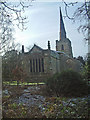
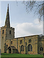
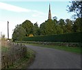
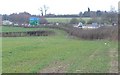
Photos of Stretton en le Field

Area Information
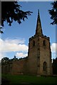
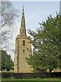
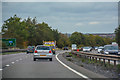
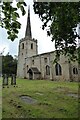
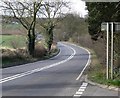
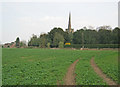
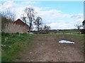
Stretton en le Field is a compact civil parish covering just 4.2 km² of Cheshire countryside. This small footprint defines the daily reality for residents, creating an environment where open spaces dominate and urban sprawl remains absent. You will find that life here moves at a slower pace than in larger towns, offering a distinct break from the rush of city living. The area serves as a quiet retreat, yet it remains accessible enough for those who require nearby amenities. Living in Stretton en le Field means embracing a lifestyle rooted in nature and community familiarity. The parish itself is a well-established entity within the broader county structure, providing a stable foundation for household growth and long-term settlement. Prospective homebuyers should appreciate that this location offers a tangible connection to the land. There are no hidden complexities here; the character of Stretton en le Field is straightforward and grounded. You can expect a neighbourhood where the scale of the settlement matches the intimacy of rural living.
- Area Type
- Parish
- Area Size
- 4.2 km²
- Population
- Not available
- Population Density
- Not available
Demographics
The community profile of Stretton en le Field is distinctly mature, with a median age of 70 years. This figure indicates that the area is heavily weighted towards older residents, likely retirees who have chosen this quiet settlement for its peaceful atmosphere. The most common age range reflects this demographic shift, confirming that the dominant population consists of those in their later life stages. Home ownership stands at an impressive 81 per cent, a statistic that underscores the establishment of long-term families within the parish. This high rate suggests that most households have bought into the local market rather than renting, fostering a sense of permanence among residents. Accommodation types align with this ownership model, supporting a stable housing stock designed for established families. Deprivation metrics do not hinder quality of life here, as the low density and high ownership rates contribute to a secure environment. You will find that the social fabric is woven from generations of residents who remain within Stretton en le Field. The ethnic composition and religious makeup follow the typical patterns for such rural parishes, contributing to a cohesive and familiar social structure.
Household Size
Accommodation Type
Tenure
Ethnic Group
Religion
Household Composition
Age
Household Deprivation
NS-SEC
Explore more demographic insights in this area
Go to Demographics tabPlanning
Planning Constraints
- Flood RiskPremium
- Ramsar Wetland SitesPremium
- Area of Outstanding Natural BeautyPremium
- Protected Nature ReservePremium
- Protected WoodlandPremium
- Crime RiskPremium