Area Overview for Stewton
Photos of Stewton

Area Information
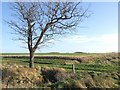
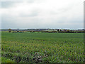
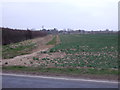
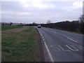
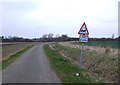
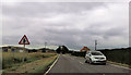
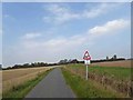
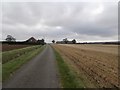
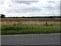
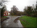
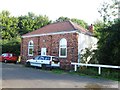
Living in Stewton offers a quiet existence within a civil parish that covers 4.2 km² of East Kent. This small area provides a contained community where daily life moves at a deliberate pace. You will find yourself surrounded by green space, but the compact size means amenities are likely within walking distance. The parish is defined by its rural character, offering a retreat from the noise of larger towns. Residents here enjoy a sense of privacy while remaining part of a local network. The landscape supports a tranquil lifestyle, ideal for those seeking calm away from urban bustle. Those considering homes in Stewton should note the intimate scale of the settlement. The entire parish is just over four square kilometres, forcing a close-knit social structure. You will experience a neighbourhood where neighbours likely know each other well. The setting provides a clear separation from heavy traffic pressures. Stewton functions as a self-contained patch of land where residents benefit from a slow rhythm. This environment suits individuals who value peace over proximity to major city centres. The physical boundaries of the parish create a distinct identity for this slice of Kent.
- Area Type
- Parish
- Area Size
- 4.2 km²
- Population
- Not available
- Population Density
- Not available
Demographics
The community in Stewton reflects a settled, older population. The median age in the area is 70, indicating a demographic dominated by retirees and long-term residents. You are looking at an area where young families are less common than established households. This age profile shapes the local culture, prioritising quieter environments and leisure over family-centric activities. Most homes in Stewton are occupied by people who have called the area home for decades. Home ownership stands at 70 per cent, meaning most locals live in properties they have paid for over time. This high level of ownership suggests stability within the community. The remaining 30 per cent of homes are likely rented, contributing to a smaller transient population. Household composition data indicates a standard distribution across the village, though the high median age often correlates with single-occupancy households or couples without children. There are no specific figures provided for ethnic diversity or religious breakdown, so the demographic picture relies heavily on age and ownership statistics. The area does not show data for housing types, but the ownership rate implies a significant stock of freehold or leasehold properties.
Household Size
Accommodation Type
Tenure
Ethnic Group
Religion
Household Composition
Age
Household Deprivation
NS-SEC
Explore more demographic insights in this area
Go to Demographics tabPlanning
Planning Constraints
- Flood RiskPremium
- Ramsar Wetland SitesPremium
- Area of Outstanding Natural BeautyPremium
- Protected Nature ReservePremium
- Protected WoodlandPremium
- Crime RiskPremium