Area Overview for Stenson Ward
Photos of Stenson Ward

Area Information
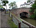
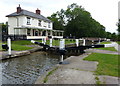
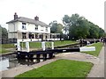
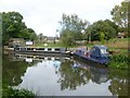
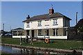
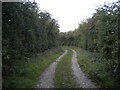
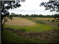
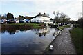
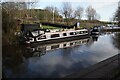
Stenson Ward is an electoral ward located within the South Derbyshire district, situated in the East Midlands region of England. You will find this area extending approximately 7.4 square kilometres, encompassing the civil parish of Stenson Fields. This development lies about 4.8 km south-southwest of Derby city centre and sits contiguous with the Sinfin area, though it remains outside the city boundary. The main settlement, Stenson Fields, functions as a semi-rural suburban housing estate featuring properties largely built from the 1970s onwards. The ward was created in 1983 when parts of the neighbouring parishes of Barrow upon Trent, Twyford, and Stenson were combined to form this new community. It was formerly part of the Ticknall ward before its current administrative status took effect. Life here blends residential calm with practical access to nearby urban facilities. Local amenities include the Stenson Fields Primary Community School, a parade of shops, and the Stenson Fields public house located on Pilgrims Way. Residents often rely on the Sinfin District Centre for major shopping needs, where an Asda supermarket is situated just outside the parish limits. Planning history shows that two further schools, comprising one primary and one secondary institution, are currently planned for the area. The coordinates of the ward align closely with 52°52′30″N 1°30′04″W, anchoring it firmly within the broader North Derbyshire landscape. Living in Stenson Ward offers a specific type of suburban experience defined by its post-war expansion history and its position bridging the gap between rural fields and larger town centres.
- Area Type
- District Borough Unitary Ward
- Area Size
- 7.4 km²
- Population
- Not available
- Population Density
- Not available
Demographics
The community profile of Stenson Ward presents a distinct demographic picture when analysed against the wider region. The median age in this ward stands at 70 years, indicating a population that is significantly older than the national average. This high median age suggests that many households are comprised of older residents, potentially those living alone or in established family units. Home ownership is exceptionally high within the ward, with 80% of residents owning their properties. This figure demonstrates a strong tradition of owner-occupation rather than renting, which often correlates with long-term community stability. Regarding accommodation types, the data provided does not specify the breakdown between detached, semi-detached, or terraced housing. However, the character description confirms that the estate consists mainly of housing developments dating from the 1970s onwards. While specific data on household composition is listed under the header `householdComposition: total`, the primary takeaway remains the significant proportion of older homeowners. The area lacks specific recorded statistics for ethnic diversity or religious affiliation in the provided dataset, so these dimensions are not currently quantifiable. The safety score of 74/100 further indicates a low crime risk, supporting the notion of a stable residential environment. You can expect to live among neighbours who have likely been in the area for decades, given the age of the housing stock and the high ownership rate.
Household Size
Accommodation Type
Tenure
Ethnic Group
Religion
Household Composition
Age
Household Deprivation
NS-SEC
Explore more demographic insights in this area
Go to Demographics tabPlanning
Planning Constraints
- Flood RiskPremium
- Ramsar Wetland SitesPremium
- Area of Outstanding Natural BeautyPremium
- Protected Nature ReservePremium
- Protected WoodlandPremium
- Crime RiskPremium