Area Overview for Staverton
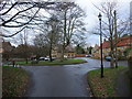
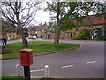
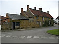
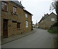
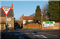
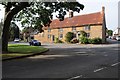
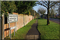
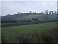
Photos of Staverton


Area Information
Staverton is a compact built-up area in England, covering 28.3 hectares. It is a small, mature community with a median age of 70, suggesting a population skewed towards older residents. The area is predominantly owner-occupied, with 82% of homes owned by their occupants, reflecting a stable, long-term resident base. Daily life in Staverton is likely characterised by a quiet, established rhythm, with residents prioritising comfort and familiarity. The proximity to retail amenities like Morrisons Daily and Aldi Daventry, combined with good broadband connectivity, ensures practical convenience. While the area’s size is modest, its infrastructure supports a self-contained lifestyle. For those seeking a low-maintenance, community-focused environment, Staverton offers a blend of practicality and tranquillity, with minimal reliance on external services. Its safety profile, with a crime risk score of 79, further reinforces its appeal as a secure place to live.
- Area Type
- Built Up Area 250
- Area Size
- 28.3 hectares
- Population
- Not available
- Population Density
- Not available
Staverton’s lifestyle is shaped by its proximity to retail amenities, including Morrisons Daily, Aldi Daventry, and Heron Daventry. These venues provide access to everyday shopping, groceries, and other services within practical reach. The area’s compact size means that these amenities are likely within walking or short driving distance, enhancing convenience for residents. While the data does not mention parks or leisure facilities, the presence of multiple retail options suggests a focus on practicality over expansive recreational spaces. The character of Staverton is likely defined by its ease of access to essential services, making it suitable for those prioritising convenience over large-scale leisure opportunities.
Amenities
Schools
The nearest school to Staverton is the Staverton Church of England Voluntary Primary School, which serves the local community. As a primary school, it caters to younger children, though the data does not provide Ofsted ratings or academic performance metrics. The presence of a single primary school suggests that families with young children may need to travel to nearby areas for secondary education. The lack of additional schools in the data means the area’s educational options are limited to primary-level institutions. For families, this implies a reliance on nearby towns for comprehensive schooling, though the proximity of the primary school offers convenience for early education.
| Rank | A + A* % | School | Type | Entry gender | Ages |
|---|---|---|---|---|---|
| 1 | N/A | Staverton Church of England Voluntary Primary School | primary | N/A | N/A |
| 2 | N/A | Staverton Church of England Voluntary Primary School | primary | N/A | N/A |
Explore more schools in this area
Go to Schools tabDemographics
Staverton’s population is predominantly aged 70, with the most common age range encompassing the total population. This suggests a community where older residents form a significant proportion, potentially influencing local services and social dynamics. Home ownership is high, at 82%, indicating a stable housing market with long-term residents. The data does not specify household composition or accommodation types, but the overall profile points to a settled, mature demographic. The absence of detailed diversity metrics means the area’s ethnic and religious composition remains unquantified, though the figures provided confirm a homogenous population structure. For quality of life, the high home ownership rate and low crime risk suggest a cohesive, low-stress environment, though the lack of specific data on deprivation limits deeper analysis.
Household Size
Accommodation Type
Tenure
Ethnic Group
Religion
Household Composition
Age
Household Deprivation
NS-SEC
Explore more demographic insights in this area
Go to Demographics tabPlanning
Planning Constraints
- Crime RiskLocked