Area Overview for Stathern
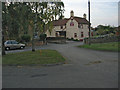
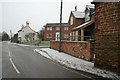
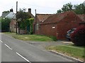
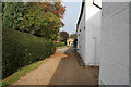
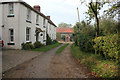
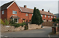
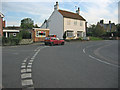
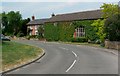
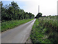
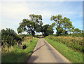
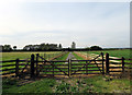
Photos of Stathern

Area Information
Stathern is a compact built-up area covering 32.6 hectares, nestled in England’s rural heartland. Its population, while small, is notable for its age profile: the median age is 70, reflecting a community predominantly composed of older residents. This demographic shapes the area’s character, with a focus on stability and established living. Daily life here is defined by proximity to essential services, including three railway stations—Elton & Orston, Bottesford, and Aslockton—each offering connections to broader networks. The presence of Stathern Primary School, rated outstanding by Ofsted, ensures families have access to high-quality early education. While the area’s size is modest, its infrastructure supports a self-contained lifestyle, with nearby retail options like Co-op Bottesford and Co-op Cropwell. Stathern’s appeal lies in its balance of quietude and practical connectivity, making it suitable for those prioritising safety, convenience, and a slower pace of life.
- Area Type
- Built Up Area 250
- Area Size
- 32.6 hectares
- Population
- Not available
- Population Density
- Not available
Stathern’s lifestyle is shaped by its proximity to essential amenities. Within practical reach are two Co-op stores—Bottesford and Cropwell—offering basic retail and grocery needs. The three railway stations provide access to broader travel options, though the exact convenience of these depends on individual locations. The area’s compact size means residents can access these services without long commutes. While the data does not mention parks or leisure facilities, the presence of multiple retail and transport options suggests a functional, if modest, lifestyle. For those valuing simplicity and accessibility, Stathern’s amenities meet daily needs effectively.
Amenities
Schools
Stathern Primary School is the sole educational institution explicitly mentioned in the data. As a primary school with an outstanding Ofsted rating, it provides high-quality early education for local children. The absence of secondary schools or further education institutions in the data suggests families may need to look beyond Stathern for secondary schooling. However, the presence of a top-rated primary school is a significant advantage, ensuring young residents receive a strong foundation in their education. For families prioritising academic standards, this school is a key draw.
| Rank | A + A* % | School | Type | Entry gender | Ages |
|---|---|---|---|---|---|
| 1 | N/A | Stathern Primary School | primary | N/A | N/A |
Explore more schools in this area
Go to Schools tabDemographics
Stathern’s population is predominantly elderly, with a median age of 70. This suggests a community where retirement is the primary life stage, shaping local dynamics and service needs. Home ownership is high at 80%, indicating a stable, long-term resident base. The data does not specify household composition or accommodation types, but the overall profile points to a population with established roots. The area’s demographic homogeneity is evident in the absence of detailed breakdowns for ethnicity or religion, though this does not necessarily imply a lack of diversity. For quality of life, the high home ownership rate may correlate with a sense of permanence, though the lack of specific data on deprivation means its impact on daily living remains unquantified.
Household Size
Accommodation Type
Tenure
Ethnic Group
Religion
Household Composition
Age
Household Deprivation
NS-SEC
Explore more demographic insights in this area
Go to Demographics tabPlanning
Planning Constraints
- Crime RiskLocked