Area Overview for Stapleford South East Ward
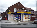
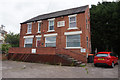
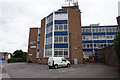
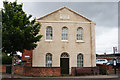
Photos of Stapleford South East Ward
Area Information
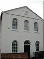
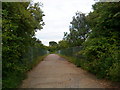
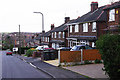
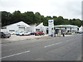
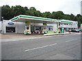
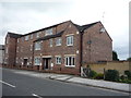
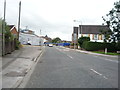
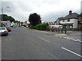
Living in Stapleford South East Ward offers a quiet residential experience just six miles west of Nottingham within the Borough of Broxtowe. This small district covers 1.5 square kilometres and forms part of the larger town of Stapleford, which straddles the border between Nottinghamshire and Derbyshire. The area neighbours Beeston to the east and Ilkeston to the north, providing easy access to wider regional amenities. You will find yourself in a historic setting where the origins trace back before the Norman Conquest. The presence of the Stone Cross in the churchyard of St Helen's church is a notable feature, believed to be the oldest Christian monument in the Midlands. This ward is home to approximately 5,185 residents according to the 2021 census, with recent estimates placing the population slightly higher at 5,420 by June 2024. Daily life here is defined by proximity to key transport links and historical significance Rather than a tourist destination, the area functions primarily as a residential community. The geography places you close to the River Trent and River Erewash, areas historically important for trade. While the landscape includes suburban housing, the absence of major planning constraints like protected woodlands or Ramsar sites means development follows standard local authority guidelines. You are situated near the A52 road, which connects you directly to Nottingham, Derby, and the A1 motorway. The town also benefits from a railway station nearby, placing you on a network that serves London, Lincoln, and Birmingham.
- Area Type
- District Borough Unitary Ward
- Area Size
- 1.5 km²
- Population
- Not available
- Population Density
- Not available
Demographics
The community in Stapleford South East Ward reflects the broader demographics of the town with a strong presence of older residents. You should expect the median age in the ward to be 70, indicating an area where many households consist of retirees or older adults. The most common age range encompasses the total population, suggesting a full spectrum of ages though weighted heavily towards senior citizens. This age profile influences the local schools near Stapleford South East Ward, which may serve a mix of younger families moving into the expanding town and the adult population. Home ownership is a defining characteristic of this neighbourhood, with 68% of households owning their property outright or with a mortgage. This high rate of ownership suggests a stable community where long-term residents have invested in their local stores and venues. The remaining 32% live in rented accommodation, contributing to a diverse range of household types within the 5,420 estimated population. Accommodation types vary across the 1.5 square kilometres but generally cater to standard residential needs without the constraints of protected status. National census figures on ethnicity and religion are aggregated for the ward rather than broken down by specific sub-groups. The household composition mirrors the national trend where single-person homes and couple-only households may be more prevalent due to the older median age. Deprivation levels are not explicitly measured in the provided data, so you must rely on local knowledge for neighbourhood vitality. The majority ownership rate often correlates with residents who have stayed put through various market cycles, creating a sense of established neighbourhood loyalty.
Household Size
Accommodation Type
Tenure
Ethnic Group
Religion
Household Composition
Age
Household Deprivation
NS-SEC
Explore more demographic insights in this area
Go to Demographics tabPlanning
Planning Constraints
- Flood RiskPremium
- Ramsar Wetland SitesPremium
- Area of Outstanding Natural BeautyPremium
- Protected Nature ReservePremium
- Protected WoodlandPremium
- Crime RiskPremium