Area Overview for Stapleford North Ward
Photos of Stapleford North Ward
Area Information
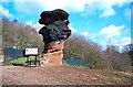
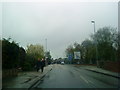
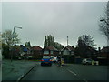
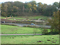
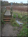
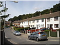
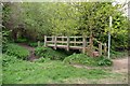
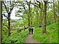
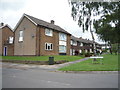
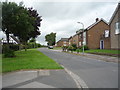
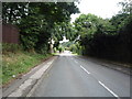
Living in Stapleford North Ward means residing in a compact district within the Borough of Broxtowe, covering just 1.5 square kilometres in the East Midlands. This area sits approximately six miles west of Nottingham, positioned near the Derbyshire border and close to the Rivers Trent and Erewash. Historically significant, dates from the Domesday Book of 1086 reveal the location's origins, with development flourishing due to its strategic trade position. The ward forms part of the wider town of Stapleford, a civil parish with a stable population figure recorded at 4,764 in 2021. Daily life here reflects a settled, historic community rather than a rapidly changing urban frontier. You are surrounded by location markers dating back centuries, including a Saxon Stone Cross at St Helen's churchyard, which stands as believed to be the oldest Christian monument in the Midlands. Nearby, the Hemlock Stone on Stapleford Hill offers geological context with origins traced to the Triassic Period roughly 200 million years ago. The area includes original Stocking Knitters' Houses on Nottingham Road and The Roach crossroads, named from Napoleonic-era events. Proximity to Ilkeston, Beeston, and Sandiacre defines the local geography, while the town council actively maintains the ward's identity. For those seeking a quiet neighbourhood anchored in deep history yet connected to wider networks, Stapleford North Ward delivers. You can walk past notable features like the unique Hemlock Stone while accessing modern amenities in the wider Broxtowe region. This small but historic district offers a grounded living experience for anyone prioritising local character over urban sprawl.
- Area Type
- District Borough Unitary Ward
- Area Size
- 1.5 km²
- Population
- Not available
- Population Density
- Not available
Demographics
The community in Stapleford North Ward is defined by a notably mature demographic profile. The median age across the ward stands at 70, indicating a population skewed heavily towards older residents compared to national averages. While specific breakdowns for the total age range are not detailed in current records, the high median suggests this area serves as a retirement destination or holds many long-term residents who have aged in place. With a total household composition and accommodation type record, the area functions as a residential hub rather than a commuter dormitory. Home ownership levels are high, with figures showing 67% of residents own their properties outright or with a mortgage. This majority ownership rate points to a stable community where people often stay for decades. The ward does not report predominant ethnic group or religious data in the available records, which is common for smaller statistical wards. This lack of detailed Diversity metrics implies a relatively homogenous or unrecorded mix of background compared to larger urban centres. For residents, the high ownership percentage typically correlates with lower rental turnover, creating quieter streets. The older median age suggests neighbours likely value stability and the established atmosphere of Stapleford North Ward. You will find a population that appreciates the local history, from the Domesday Book origins to the historic crossroads nearby. The community feels settled, suited for those prioritising a slow-paced, owner-occupied lifestyle over high-churn rental markets.
Household Size
Accommodation Type
Tenure
Ethnic Group
Religion
Household Composition
Age
Household Deprivation
NS-SEC
Explore more demographic insights in this area
Go to Demographics tabPlanning
Planning Constraints
- Flood RiskPremium
- Ramsar Wetland SitesPremium
- Area of Outstanding Natural BeautyPremium
- Protected Nature ReservePremium
- Protected WoodlandPremium
- Crime RiskPremium