Area Overview for Stapleford
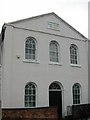
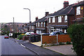
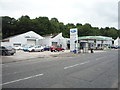
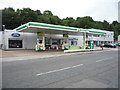
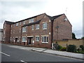
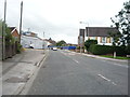
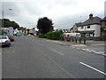
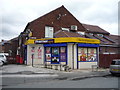
Photos of Stapleford


Area Information
Stapleford is a compact built-up area covering 3.2 square kilometres with a total population of 1,111 residents. This small footprint supports a community with a population density of 342 people per square kilometre, giving it a distinct character separate from larger urban sprawls. The area functions as a local neighbourhood rather than a self-contained town, relying on the wider region for extensive services while maintaining its own local identity. Living in Stapleford means experiencing a settlement of modest scale where daily life moves at a steadier pace. The demographic profile suggests a mature community, as the median age sits at 70 years. This statistic defines the social fabric of the district and influences local needs. You will find a resident base that has likely settled long-term, resulting in stable neighbourhood dynamics. The area does not compete for high online visibility or major tourist footfall, but it offers a specific niche for those seeking a quieter environment with established routines. Homes in Stapleford sit within a landscape shaped by decades of local development, creating a setting that prioritises residence over commercial spectacle.
- Area Type
- Built Up Area 250
- Area Size
- 3.2 km²
- Population
- 1111
- Population Density
- 342 people/km²
Residents of Stapleford have access to a range of amenities within practical reach, including retail outlets, tram stops, and railway stations. For shopping needs, you can visit Aldi Nottingham, Iceland Stapleford, and Sainsburys Derby, which are located nearby and serve the community. Five notable transport hubs facilitate movement to wider Nottinghamshire and Derby. These include the Tram Park & Ride, Toton Lane Tram Stop, and Inham Road for tram services. The rail network offers connections to Attenborough Railway Station, Beeston Railway Station, and Long Eaton Railway Station. This mix of metro and rail options ensures that commuting to jobs or leisure destinations is straightforward. The proximity of these transport nodes means you do not need to travel far to access major services. Daily life in Stapleford balances local convenience with regional mobility. You can walk to key services or easily access the tram and train lines for longer journeys. The presence of these specific venues anchors the lifestyle, making the area functional for both everyday errands and weekend trips.
Amenities
Schools
Five educational institutions serve the area, offering a mix of primary education options for families with school-age children. These include Albany Junior School, which holds a Good Ofsted rating, and Albany Infant and Nursery School, which also carries a Good Ofsted rating. Stevenson Junior School, Frederick Harrison Infant and Nursery School, and William Lilley Infant and Nursery School complete the list of nearest schools. The presence of multiple primary schools provides families with several choices for their children's education. Of the five schools listed, three have achieved a Good rating, indicating a generally high standard of education in the immediate vicinity. You will find the school system is focused on younger ages, typical for a neighbourhood with a slightly older resident median age. There is no secondary or high school specifically listed within the immediate dataset, meaning families with older children may need to look slightly further afield for comprehensive education. For those living in Stapleford, the local education provision is centred on the primary stage of a child's development.
| Rank | School | Type | Entry gender | Ages |
|---|
Explore more schools in this area
Go to Schools tabDemographics
The community within Stapleford is defined by an older resident base, with a median age of 70 years. This demographic reality shapes the social environment and local demand for specific services. A majority of households in the area own their homes, with home ownership levels standing at 70 percent. This high level of tenure indicates a long-term stability for families and residents who have established roots in the locality. The primary household composition and accommodation type data reflect this settled nature, showing that most residents reside in properties they occupy permanently. Although specific figures for ethnicity and religion are not broken down in the available records, the overall population structure points towards a mature demographic. The predominant household types tend to mirror the needs of an older population, influencing local commerce and social interaction. Present deprivation data is not highlighted in the current records, but the socio-economic picture is largely one of stability. You can expect a neighbourhood where residents have invested in their properties and where the community revolves around established patterns of living rather than transient occupancy.
Household Size
Accommodation Type
Tenure
Ethnic Group
Religion
Household Composition
Age
Household Deprivation
NS-SEC
Explore more demographic insights in this area
Go to Demographics tabPlanning
Planning Constraints
- Crime RiskPremium