Area Overview for Stanwick
Photos of Stanwick


Area Information
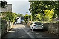
Stanwick is a compact built-up area in England, covering 55.6 hectares. Its small size means residents are close to essential services and amenities, fostering a tight-knit community feel. The area’s population skews older, with a median age of 70, suggesting a demographic that values stability and established infrastructure. Daily life in Stanwick is shaped by its proximity to Wellingborough Railway Station, which connects to broader transport networks, and its nearby schools, including Stanwick Primary School. The area’s retail options, such as Co-op Raunds and Asda Raunds, provide convenience for everyday needs. While its size limits sprawling development, Stanwick’s compact nature ensures a manageable, accessible environment. For those seeking a quieter, well-served location with practical amenities, Stanwick offers a blend of simplicity and connectivity. Its character is defined by a balance between local traditions and modern essentials, making it appealing to those prioritising ease of access over urban vibrancy.
- Area Type
- Built Up Area 250
- Area Size
- 55.6 hectares
- Population
- Not available
- Population Density
- Not available
Stanwick’s lifestyle is shaped by its proximity to practical amenities. The area has five retail outlets, including Co-op Raunds, Spar, and Asda Raunds, providing everyday shopping options within reach. These stores cater to local needs, from groceries to household essentials. The Wellingborough Railway Station adds convenience for commuters and access to broader services. While the data does not mention parks or leisure facilities, the compact nature of the area suggests that local amenities are designed for immediate accessibility. This setup supports a lifestyle focused on simplicity and efficiency, ideal for those who prioritise ease of access over expansive recreational spaces.
Amenities
Schools
The nearest school to Stanwick is Stanwick Primary School, which serves the local community with a good Ofsted rating. This primary school is the only educational institution explicitly mentioned in the data, indicating that the area’s schooling options are limited to primary education. Families with children may need to consider commuting to secondary schools in nearby towns, as no secondary schools are listed. The presence of a well-rated primary school is a positive factor for families prioritising early education, though the absence of further schools may influence decisions for those requiring a full range of educational facilities.
| Rank | School | Type | Entry gender | Ages |
|---|
Explore more schools in this area
Go to Schools tabDemographics
Stanwick’s population has a median age of 70, indicating a community predominantly composed of older adults. This age profile suggests a stable, long-established demographic with lower turnover rates. Home ownership in the area stands at 69%, reflecting a mix of owner-occupied properties and rental units. The accommodation types and household compositions are not specified, but the high home ownership rate implies a preference for long-term residency over transient tenancy. The predominant ethnic group and religious affiliations are not detailed in the data, so broader generalisations are not possible. The area’s older population may influence local services and amenities, with a focus on accessibility and healthcare provisions. For buyers considering Stanwick, the demographic profile highlights a community that values continuity and familiarity, though it may lack the diversity of younger, more dynamic areas.
Household Size
Accommodation Type
Tenure
Ethnic Group
Religion
Household Composition
Age
Household Deprivation
NS-SEC
Explore more demographic insights in this area
Go to Demographics tabPlanning
Planning Constraints
- Crime RiskPremium