Area Overview for Stamford
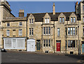
Photos of Stamford


Area Information
Living in Stamford offers a compact, well-defined urban experience within England’s Lincolnshire region. Covering just 5.5 km², the area is home to 4,716 residents, creating a densely populated yet manageable community. With a median age of 70, Stamford is a place where older generations predominate, shaping a quiet, stable atmosphere. The town’s character is defined by its proximity to essential services, including a railway station and several primary schools, ensuring daily life is practical and accessible. Residents benefit from excellent broadband connectivity, scoring 93 out of 100, which supports both home and work needs. While Stamford lacks the sprawling infrastructure of larger cities, its small size fosters a sense of familiarity, with local shops like Waitrose and Tesco within walking distance. The area’s safety profile, with a crime risk score of 75, adds to its appeal for those seeking a secure, low-stress environment. For buyers, Stamford represents a blend of simplicity and reliability, ideal for those prioritising comfort over urban vibrancy.
- Area Type
- Built Up Area 250
- Area Size
- 5.5 km²
- Population
- 4716
- Population Density
- 851 people/km²
Stamford’s lifestyle is shaped by its compact size and proximity to essential amenities. The town features five retail outlets, including Waitrose, Tesco, and M&S, ensuring everyday shopping needs are met without lengthy trips. The railway station and bus interchange provide access to nearby towns and cities, while RAF Wittering offers a unique point of interest for those interested in military history. The presence of multiple primary schools contributes to a community-focused environment, with families able to access education within walking distance. Parks and green spaces are not explicitly mentioned in the data, but the area’s low crime rate and quiet atmosphere suggest a balance between urban convenience and a sense of safety. For residents, Stamford offers a practical, low-maintenance lifestyle with easy access to services, making it ideal for those prioritising simplicity and security.
Amenities
Schools
Stamford offers five primary schools within its boundaries, including The Bluecoat School, Stamford St Gilberts Church of England Primary School, and St George’s Church of England Aided Primary School, which holds an Ofsted rating of good. Other institutions include The Saint Augustine’s Catholic Primary School and Stamford Queen Eleanor School. The mix of church-affiliated and state-funded schools provides families with options that align with their educational and religious preferences. The presence of multiple primary schools ensures that children have access to education without long commutes, a key consideration for families. The good Ofsted rating at St George’s highlights a school with strong performance in areas such as teaching quality and student outcomes. However, the data does not include secondary schools or further education institutions, meaning families may need to look beyond Stamford for comprehensive schooling.
| Rank | School | Type | Entry gender | Ages |
|---|
Explore more schools in this area
Go to Schools tabDemographics
Stamford’s population of 4,716 is concentrated within 5.5 km², resulting in a density of 851 people per square kilometre. The median age of 70 indicates a community where older residents form the majority, which influences the area’s pace of life and social dynamics. Home ownership stands at 68%, suggesting a stable housing market with a significant proportion of long-term residents. The data does not specify household composition or accommodation types, but the high proportion of older adults may correlate with a higher share of family homes or properties suited to retirement. The absence of detailed diversity metrics means Stamford’s ethnic and religious makeup remains unquantified in this dataset. However, the presence of multiple primary schools, including church-affiliated institutions, hints at a community with varied cultural and educational priorities. For buyers, this demographic profile suggests a market where property values may reflect long-term occupancy and a preference for established, low-maintenance homes.