Area Overview for Stainfield
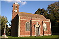
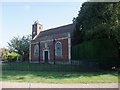
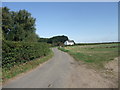
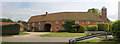
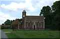
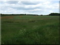
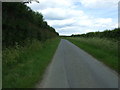
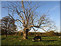
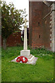
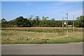
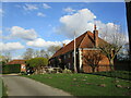
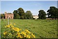
Photos of Stainfield
Area Information
Living in Stainfield means settling into a civil parish that covers 8.5 square kilometres. This relatively compact space defines the scale of daily life for residents, creating a contained community where distances to local spots remain short. The area sits within England, offering a defined boundary for those seeking a specific rural lifestyle. Unlike sprawling urban developments, Stainfield presents a parish structure that keeps neighbourhoods close-knit. You will find yourself in an environment where the 8.5 km² footprint dictates the rhythm of the year. The character of the parish is shaped entirely by its physical limits, ensuring that every walk feels significant without becoming exhausting. Prospective homeowners often value this clarity of scale, as it prevents the feeling of being lost in a vast, unnamed bore. Instead, you obtain a precise definition of your place in the wider map. The size of the parish acts as a natural filter, screening out those who desire anonymity in favour of residents who prefer a clearly bounded home environment. This geographic precision offers a sense of stability that larger, unstructured regions cannot match.
- Area Type
- Parish
- Area Size
- 8.5 km²
- Population
- Not available
- Population Density
- Not available
Demographics
The community in Stainfield reflects a settled population with a median age of 70. Most residents fall into the older age bracket, indicating a village where retirement and long-term living dominate the demographic picture. This age profile suggests a neighbourhood where stability takes precedence over young families or transient workers. Homeownership stands at an impressive 73%, proving that the vast majority of households call Stainfield their permanent residence rather than a rental stop. This high rate of ownership correlates with the older age structure, as current owners often move only when they sell the property permanently or pass it on. Accommodation types and household compositions align with this pattern of permanence, creating a static and reliable social fabric. You will encounter neighbours who likely share similar life stages and long-standing roots. The low fluidity of the population means that community habits remain consistent over decades. There is little turnover of new families bringing fresh dynamics, which reinforces the established character of the parish.
Household Size
Accommodation Type
Tenure
Ethnic Group
Religion
Household Composition
Age
Household Deprivation
NS-SEC
Explore more demographic insights in this area
Go to Demographics tabPlanning
Planning Constraints
- Flood RiskPremium
- Ramsar Wetland SitesPremium
- Area of Outstanding Natural BeautyPremium
- Protected Nature ReservePremium
- Protected WoodlandPremium
- Crime RiskPremium