Area Overview for St. Thomas' Ward
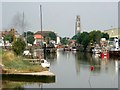
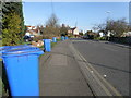
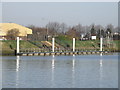
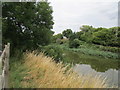
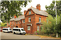
Photos of St. Thomas' Ward


Area Information
St. Thomas' Ward occupies a compact 2.8 km² space within the district, presenting a highly specific living environment for those seeking this location. The area's small footprint means the physical environment is tightly defined, creating a neighbourhood where boundaries are clear and distances are short. Residential life here is characterised by a very mature population, making it distinct from the busier family zones often sought by younger buyers. The sense of place is formed by residents who have likely lived in their homes for decades, resulting in a community with deep local roots. You will find that daily life revolves around established routines and long-standing neighbours rather than transient populations. This stability offers a quiet consistency, though it brings a specific demographic reality that prospective buyers should consider carefully. The ward functions as a largely self-contained residential area where the character is set by age and tenure patterns. Whether you are looking at homes in St. Thomas' Ward or simply wishing to understand the setting, the data reveals a place defined by permanence and a high proportion of existing ownership. Your experience here will be shaped by the fact that the area is small, mature, and overwhelmingly owned by its current residents.
- Area Type
- District Borough Unitary Ward
- Area Size
- 2.8 km²
- Population
- Not available
- Population Density
- Not available
Demographics
The community in St. Thomas' Ward is defined by a significantly older population, with a median age of 70 years. This figure places the area well above the national average for age, indicating a demographic where residents are predominantly retirees or seniors. Consequently, the household composition likely reflects families with fewer children and a higher presence of single-person households or couples without dependents. Home ownership stands at 70 per cent, a figure that suggests a community stable enough to have accumulated property equity over long periods. This high ownership rate contrasts sharply with rental-heavy urban zones and points to an area where residents have decided to settle permanently. The accommodation type, ethnicity, and religion data categorise the ward as a total community, reflecting its broad but age-specific nature. Living in St. Thomas' Ward, you would expect a quieter atmosphere than in areas with younger demographics. The age profile means that schools near St. Thomas' Ward might see fewer local children attending compared to more mixed wards. The 70 per cent ownership figure reinforces the stability of this demographic, showing a community built on long-term residency rather than transient living arrangements.
Household Size
Accommodation Type
Tenure
Ethnic Group
Religion
Household Composition
Age
Household Deprivation
NS-SEC
Explore more demographic insights in this area
Go to Demographics tabPlanning
Planning Constraints
- Flood RiskPremium
- Ramsar Wetland SitesPremium
- Area of Outstanding Natural BeautyPremium
- Protected Nature ReservePremium
- Protected WoodlandPremium
- Crime RiskPremium